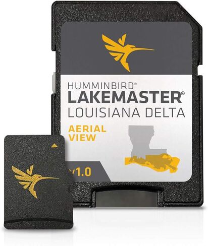
LakeMaster Louisiana Delta Aerial View, Version 1 provides highresolution aerial photography of shorelines, waterways, landmarks, obstructions, roads, marinas, canals, and channels
The LakeMaster Louisiana Delta's digital maps can overlay on top of other navigation charts, such as Humminbird Basemap on compatible GPSequipped Humminbird fish finders
View all the hidden features of the Louisiana Delta you've been missing from traditional maps with Humminbird LakeMaster Aerial View.
An essential tool for fishing Louisiana's coastal water, it also includes navigation aids, lake names, points of interest, and more
The LakeMaster Louisiana Delta Aerial View digital maps come on a Micro SD card (with included SD card adapter) that's compatible with all GPSequipped HELIX, SOLIX, ONIX, and ION Series models and sel
وصف
LakeMaster Aerial Satellite ViewLouisiana DeltaHumminbird LakeMaster now offers high resolution aerial photography of the Louisiana Delta on one micro card (with SD adaptor). Always know where you are with real life aerial views of shorelines, waterways, landmarks, obstructions, roads, marinas, canals, and channels. Also includes nav aids, lake names, points of interest and more