- التسوق ، جعل بسهولة.
- /
- احصل على التطبيق!
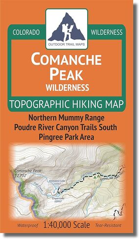
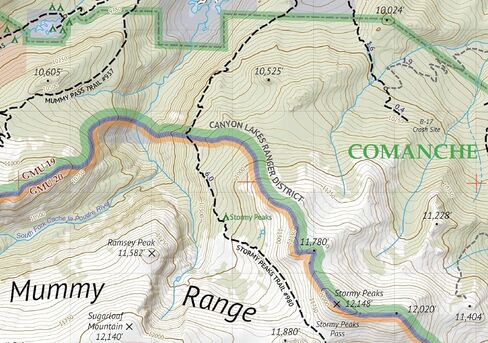
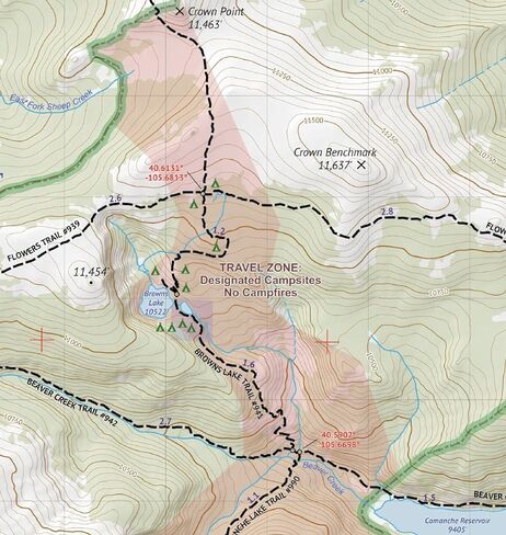
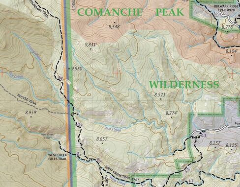
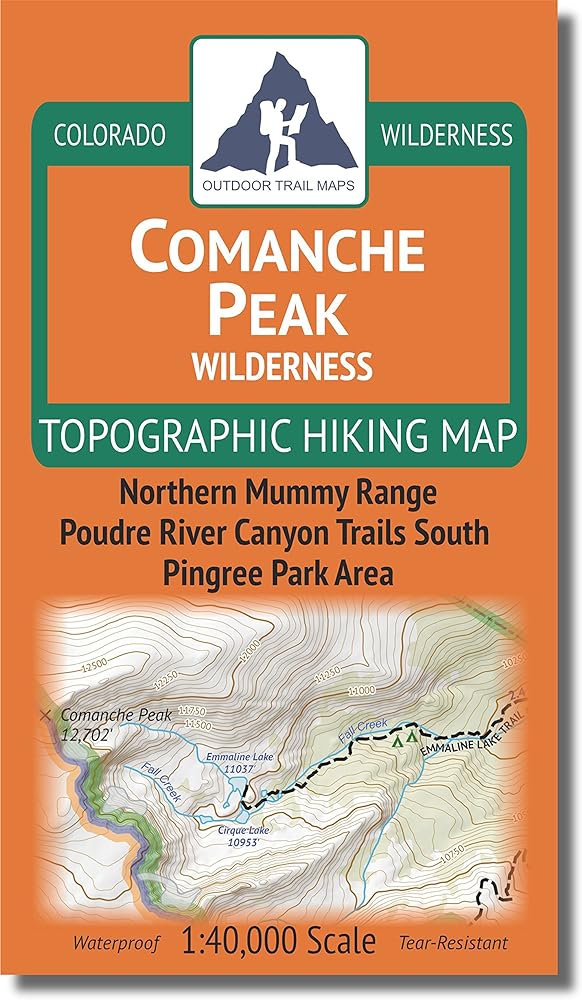
Waterproof, tear-resistant topographic hiking map covering 80 miles of trails in the Comanche Peak Wilderness of Northern Colorado and an additional 110 miles of trail in the surroundings (including the northeast corner of Rocky Mountain National Park). The front of the map shows the trails in the western half of the wilderness area, including the Big South Trail along the Cache La Poudre River, the trails around Crown Point Road, Browns Lake, Comanche Lake and Comanche Peak. The back of the map shows the eastern half of the wilderness area, including trails around Pingree Park (CSU Pingree Park Campus), Signal Mountain and the North Fork Trail and North Boundary Trail areas into the Rocky Mountain National Park.
 Sangre de Cristo Wilderness NORTH - خريطة كولورادو الطبوغرافية للمشي لمسافات طويلة (2022)
KWD 4
Sangre de Cristo Wilderness NORTH - خريطة كولورادو الطبوغرافية للمشي لمسافات طويلة (2022)
KWD 4
 راوة وايلدرنيس - خريطة كولورادو الطبوغرافية للمشي لمسافات طويلة (2018)
KWD 4
راوة وايلدرنيس - خريطة كولورادو الطبوغرافية للمشي لمسافات طويلة (2018)
KWD 4
 Lizard Head - جبل سنيفيلز البرية - خريطة كولورادو الطبوغرافية للمشي لمسافات طويلة (2018)
KWD 4
Lizard Head - جبل سنيفيلز البرية - خريطة كولورادو الطبوغرافية للمشي لمسافات طويلة (2018)
KWD 4
 Outdoor Trail Maps LLC Eagles Nest Wilderness - خريطة كولورادو الطبوغرافية للمشي لمسافات طويلة (2018)
KWD 4
Outdoor Trail Maps LLC Eagles Nest Wilderness - خريطة كولورادو الطبوغرافية للمشي لمسافات طويلة (2018)
KWD 4