- التسوق ، جعل بسهولة.
- /
- احصل على التطبيق!
خريطة طوبوغرافية للمشي لمسافات طويلة مقاومة للماء ومقاومة للتمزق تغطي جميع مسارات المشي لمسافات طويلة في الجزء الشمالي من Sangre de Cristo Wilderness جنوب ساليدا وغرب ويستكليف، بما في ذلك أجزاء من غابة ريو غراندي الوطنية وغابة سان إيزابيل الوطنية. الجانب الأمامي من الخريطة يوضح الممرات الواقعة غرب Westcliffe، بما في ذلك Comanche-Venable Loop وبحيرة السحاب والمزيد. يُظهر الجزء الخلفي من الخريطة الجزء الشمالي تمامًا من Sangre de Cristo Wilderness، بما في ذلك بحيرات Brush Creek وElectric Peak وRainbow Lake وCoton Creek Trail وMajor Creek Trail والمزيد. انظر خريطة Sangre de Cristo Wilderness SOUTH بشكل منفصل لتغطية الجزء الجنوبي من البرية.
 راوة وايلدرنيس - خريطة كولورادو الطبوغرافية للمشي لمسافات طويلة (2018)
KWD 4
راوة وايلدرنيس - خريطة كولورادو الطبوغرافية للمشي لمسافات طويلة (2018)
KWD 4
 Lizard Head - جبل سنيفيلز البرية - خريطة كولورادو الطبوغرافية للمشي لمسافات طويلة (2018)
KWD 4
Lizard Head - جبل سنيفيلز البرية - خريطة كولورادو الطبوغرافية للمشي لمسافات طويلة (2018)
KWD 4
 Outdoor Trail Maps LLC Eagles Nest Wilderness - خريطة كولورادو الطبوغرافية للمشي لمسافات طويلة (2018)
KWD 4
Outdoor Trail Maps LLC Eagles Nest Wilderness - خريطة كولورادو الطبوغرافية للمشي لمسافات طويلة (2018)
KWD 4
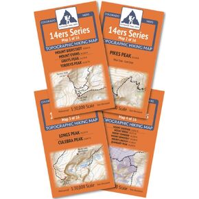 خرائط الممرات الخارجية حزمة خريطة نطاق كولورادو 14ers من سلسلة Front-Tenmile-Mosquito
KWD 9
خرائط الممرات الخارجية حزمة خريطة نطاق كولورادو 14ers من سلسلة Front-Tenmile-Mosquito
KWD 9


