- Shopping, made easy.
- /
- Get the app!
 Rawah Wilderness - Colorado Topographic Hiking Map (2018)
KWD 4
Rawah Wilderness - Colorado Topographic Hiking Map (2018)
KWD 4
 Boulder County Recreation Topographic Map
KWD 8.500
Boulder County Recreation Topographic Map
KWD 8.500
 Outdoor Trail Maps LLC Eagles Nest Wilderness - Colorado Topographic Hiking Map (2018)
KWD 4
Outdoor Trail Maps LLC Eagles Nest Wilderness - Colorado Topographic Hiking Map (2018)
KWD 4
 Outdoor Trail Maps Colorado 14ers Series Front-Tenmile-Mosquito Range Map Pack
KWD 9
Outdoor Trail Maps Colorado 14ers Series Front-Tenmile-Mosquito Range Map Pack
KWD 9
 Indian Peaks - James Peak Wilderness - Colorado Topographic Hiking Map (2021)
KWD 4
Indian Peaks - James Peak Wilderness - Colorado Topographic Hiking Map (2021)
KWD 4
 Outdoor Trail Maps LLC Lost Creek Wilderness - Colorado Topographic Hiking Map (2022)
KWD 4
Outdoor Trail Maps LLC Lost Creek Wilderness - Colorado Topographic Hiking Map (2022)
KWD 4
 Outdoor Trail Maps Maroon Bells-Snowmass Wilderness - Colorado Topographic Hiking Map (2022)
KWD 4
Outdoor Trail Maps Maroon Bells-Snowmass Wilderness - Colorado Topographic Hiking Map (2022)
KWD 4
 Outdoor Trail Maps Taos Wilderness Areas - New Mexico Hiking (2023)
KWD 4.500
Outdoor Trail Maps Taos Wilderness Areas - New Mexico Hiking (2023)
KWD 4.500
 YellowMaps Cape Vincent NY topo map, 1:62500 Scale, 15 X 15 Minute, Historical, 1895, Updated 1917, 20 x 16.6 in
KWD 12.500
YellowMaps Cape Vincent NY topo map, 1:62500 Scale, 15 X 15 Minute, Historical, 1895, Updated 1917, 20 x 16.6 in
KWD 12.500
 Garmin Topo Alaska Enhanced, Garmin MicroSD/SD
KWD 32.500
Garmin Topo Alaska Enhanced, Garmin MicroSD/SD
KWD 32.500
 -15%
Guatemala Map (National Geographic Adventure Map, 3110)
KWD 5.500
-15%
Guatemala Map (National Geographic Adventure Map, 3110)
KWD 5.500
 Shenandoah National Park Map (National Geographic Trails Illustrated Map, 228)
KWD 6.500
Shenandoah National Park Map (National Geographic Trails Illustrated Map, 228)
KWD 6.500
![Big Sur, Ventana Wilderness Map [Los Padres National Forest] (National Geographic Trails Illustrated Map, 814)](https://cdn1.tilga.com/md/prod/2/896/3/57033143.32249.jpg) -31%
Big Sur, Ventana Wilderness Map [Los Padres National Forest] (National Geographic Trails Illustrated Map, 814)
KWD 4.500
-31%
Big Sur, Ventana Wilderness Map [Los Padres National Forest] (National Geographic Trails Illustrated Map, 814)
KWD 4.500
 Angeles National Forest Map (National Geographic Trails Illustrated Map, 811)
KWD 6.500
Angeles National Forest Map (National Geographic Trails Illustrated Map, 811)
KWD 6.500
 Scratch Off Colorado Fourteeners Map Poster - 14ers Mountain Peaks - Ideal Bucket list Gift for Climbers - 22 x 17
KWD 7
Scratch Off Colorado Fourteeners Map Poster - 14ers Mountain Peaks - Ideal Bucket list Gift for Climbers - 22 x 17
KWD 7
 Mount Jefferson, Mount Washington Map (National Geographic Trails Illustrated Map, 819)
KWD 6.500
Mount Jefferson, Mount Washington Map (National Geographic Trails Illustrated Map, 819)
KWD 6.500
![Tahoe National Forest West Map [Yuba and American Rivers] (National Geographic Trails Illustrated Map, 804)](https://cdn1.tilga.com/md/prod/2/907/3/57199706.47853.jpg) Tahoe National Forest West Map [Yuba and American Rivers] (National Geographic Trails Illustrated Map, 804)
KWD 6.500
Tahoe National Forest West Map [Yuba and American Rivers] (National Geographic Trails Illustrated Map, 804)
KWD 6.500
 Butler Maps G1 Regional Motorcycle Map (Southern California)
KWD 9
Butler Maps G1 Regional Motorcycle Map (Southern California)
KWD 9
 Southern Wind River Range Hikng Map
KWD 4.500
Southern Wind River Range Hikng Map
KWD 4.500
 -10%
Yellowstone Lake: Yellowstone National Park SE Map (National Geographic Trails Illustrated Map, 305)
KWD 4.500
-10%
Yellowstone Lake: Yellowstone National Park SE Map (National Geographic Trails Illustrated Map, 305)
KWD 4.500
![Mount Rogers National Recreation Area Map [Jefferson National Forest] (National Geographic Trails Illustrated Map, 786)](https://cdn1.tilga.com/md/prod/2/1214/3/61394450.60486.jpg) Mount Rogers National Recreation Area Map [Jefferson National Forest] (National Geographic Trails Illustrated Map, 786)
KWD 6.500
Mount Rogers National Recreation Area Map [Jefferson National Forest] (National Geographic Trails Illustrated Map, 786)
KWD 6.500
 Buena Vista, Collegiate Peaks Map (National Geographic Trails Illustrated Map, 129)
KWD 6.500
Buena Vista, Collegiate Peaks Map (National Geographic Trails Illustrated Map, 129)
KWD 6.500
 Grand Canyon Colorado River Rafting Pocket Topo Guides & Maps (12x18" Tear-Resistant/Waterproof)
KWD 5.500
Grand Canyon Colorado River Rafting Pocket Topo Guides & Maps (12x18" Tear-Resistant/Waterproof)
KWD 5.500
 -22%
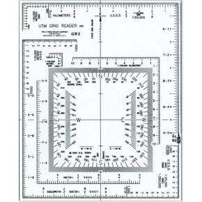
Westcott UTM Map Grid Reader/Plotter, 5" by 6", Transparent (GR-2)
KWD 3.500
-22%
Westcott UTM Map Grid Reader/Plotter, 5" by 6", Transparent (GR-2)
KWD 3.500
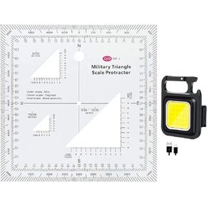 1.2mm Transparent Plastic Military UTM/MGRS Coordinate Scale Map Reading and Land Navigation Topographical Map Scale, Protractor and Grid Coordinate Reader
KWD 4.500
1.2mm Transparent Plastic Military UTM/MGRS Coordinate Scale Map Reading and Land Navigation Topographical Map Scale, Protractor and Grid Coordinate Reader
KWD 4.500
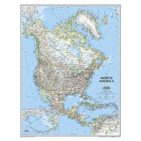 National Geographic North America Wall Map - Classic - Laminated (23.5 x 30.25 in) (National Geographic Reference Map)
KWD 10.500
National Geographic North America Wall Map - Classic - Laminated (23.5 x 30.25 in) (National Geographic Reference Map)
KWD 10.500
 -20%
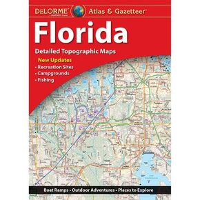
Delorme Atlas & Gazetteer: Florida
KWD 10
-20%
Delorme Atlas & Gazetteer: Florida
KWD 10
 Delorme Atlas & Gazetteer: Missouri
KWD 12
Delorme Atlas & Gazetteer: Missouri
KWD 12
 -12%
Delorme Atlas & Gazetteer: Wyoming
KWD 11
-12%
Delorme Atlas & Gazetteer: Wyoming
KWD 11
 Azores Tour & Trail Super-Durable Map (2nd edition)
KWD 9.500
Azores Tour & Trail Super-Durable Map (2nd edition)
KWD 9.500
 -6%
Delorme Atlas & Gazetteer: Nebraska
KWD 7.500
-6%
Delorme Atlas & Gazetteer: Nebraska
KWD 7.500
 Whistler, BC Canada No. 92J1S (Green Trails Maps)
KWD 6
Whistler, BC Canada No. 92J1S (Green Trails Maps)
KWD 6