- Shopping, made easy.
- /
- Get the app!
 YellowMaps Clanton East AL topo map, 1:24000 Scale, 7.5 X 7.5 Minute, Historical, 1972, Updated 1984, 26.7 x 21.9 in
KWD 12.500
YellowMaps Clanton East AL topo map, 1:24000 Scale, 7.5 X 7.5 Minute, Historical, 1972, Updated 1984, 26.7 x 21.9 in
KWD 12.500
 Lizard Head - Mount Sneffels Wilderness - Colorado Topographic Hiking Map (2018)
KWD 4
Lizard Head - Mount Sneffels Wilderness - Colorado Topographic Hiking Map (2018)
KWD 4
 Beartooth Publishing Wind River Range South, Wyoming Topographic Shaded Relief Outdoor Recreation Map
KWD 8
Beartooth Publishing Wind River Range South, Wyoming Topographic Shaded Relief Outdoor Recreation Map
KWD 8
 YellowMaps Dyas AL topo map, 1:50000 Scale, 15 X 15 Minute, Historical, 2003, 29.1 x 22.1 in
KWD 16.500
YellowMaps Dyas AL topo map, 1:50000 Scale, 15 X 15 Minute, Historical, 2003, 29.1 x 22.1 in
KWD 16.500
 Outdoor Trail Maps Pikes Peak and Colorado Springs - Topographic Hiking Map (2020)
KWD 4.500
Outdoor Trail Maps Pikes Peak and Colorado Springs - Topographic Hiking Map (2020)
KWD 4.500
 Map Ruler for Measuring LAT/Lon, Miles, and Kilometers at a Single map Scale
KWD 3
Map Ruler for Measuring LAT/Lon, Miles, and Kilometers at a Single map Scale
KWD 3
 Outdoor Trail Maps Sangre de Cristo Wilderness Map Pack: North Map and South Map
KWD 6.500
Outdoor Trail Maps Sangre de Cristo Wilderness Map Pack: North Map and South Map
KWD 6.500
 YellowMaps Lake Norman North NC topo map, 1:24000 Scale, 7.5 X 7.5 Minute, Historical, 1970, Updated 1992, 26.8 x 21.8 in
KWD 12.500
YellowMaps Lake Norman North NC topo map, 1:24000 Scale, 7.5 X 7.5 Minute, Historical, 1970, Updated 1992, 26.8 x 21.8 in
KWD 12.500
 Outdoor Trail Maps Poudre Canyon - Colorado Topographic Hiking Map (2020)
KWD 4.500
Outdoor Trail Maps Poudre Canyon - Colorado Topographic Hiking Map (2020)
KWD 4.500
 YellowMaps Peoria IL topo map, 1:250000 Scale, 1 X 2 Degree, Historical, 1990, Updated 1990, 22 x 33.6 in
KWD 16.500
YellowMaps Peoria IL topo map, 1:250000 Scale, 1 X 2 Degree, Historical, 1990, Updated 1990, 22 x 33.6 in
KWD 16.500
 Los Alamos - New Mexico Hiking (2023)
KWD 4.500
Los Alamos - New Mexico Hiking (2023)
KWD 4.500
 Aspen Area Hiking Map Pack: Maroon Bells-Snowmass, Hunter-Fryingpan, Mt Massive, Collegiate Peaks
KWD 9.500
Aspen Area Hiking Map Pack: Maroon Bells-Snowmass, Hunter-Fryingpan, Mt Massive, Collegiate Peaks
KWD 9.500
 Colorado 14ers Maps Series 11 of 16 - Capitol | Snowmass
KWD 2.500
Colorado 14ers Maps Series 11 of 16 - Capitol | Snowmass
KWD 2.500
 -11%
Franko Maps MAP FML CA Santa Catalina Guide
KWD 4
-11%
Franko Maps MAP FML CA Santa Catalina Guide
KWD 4
 YellowMaps Allentown East PA topo map, 1:24000 Scale, 7.5 X 7.5 Minute, Historical, 1964, Updated 1984, 27 x 22 in
KWD 12.500
YellowMaps Allentown East PA topo map, 1:24000 Scale, 7.5 X 7.5 Minute, Historical, 1964, Updated 1984, 27 x 22 in
KWD 12.500
 Official Central Pennsylvania Appalachian Trail Maps
KWD 8.500
Official Central Pennsylvania Appalachian Trail Maps
KWD 8.500
 Garmin Delorme Atlas & Gazetteer Paper Maps- NH/VT, AA-008826-000
KWD 13
Garmin Delorme Atlas & Gazetteer Paper Maps- NH/VT, AA-008826-000
KWD 13
 -15%
Guatemala Map (National Geographic Adventure Map, 3110)
KWD 5.500
-15%
Guatemala Map (National Geographic Adventure Map, 3110)
KWD 5.500
 Shenandoah National Park Map (National Geographic Trails Illustrated Map, 228)
KWD 6.500
Shenandoah National Park Map (National Geographic Trails Illustrated Map, 228)
KWD 6.500
 -15%
Olympic National Park Map (National Geographic Trails Illustrated Map, 216)
KWD 5.500
-15%
Olympic National Park Map (National Geographic Trails Illustrated Map, 216)
KWD 5.500
![Big Sur, Ventana Wilderness Map [Los Padres National Forest] (National Geographic Trails Illustrated Map, 814)](https://cdn1.tilga.com/md/prod/2/896/3/57033143.32249.jpg) -31%
Big Sur, Ventana Wilderness Map [Los Padres National Forest] (National Geographic Trails Illustrated Map, 814)
KWD 4.500
-31%
Big Sur, Ventana Wilderness Map [Los Padres National Forest] (National Geographic Trails Illustrated Map, 814)
KWD 4.500
 Angeles National Forest Map (National Geographic Trails Illustrated Map, 811)
KWD 6.500
Angeles National Forest Map (National Geographic Trails Illustrated Map, 811)
KWD 6.500
 Mount Jefferson, Mount Washington Map (National Geographic Trails Illustrated Map, 819)
KWD 6.500
Mount Jefferson, Mount Washington Map (National Geographic Trails Illustrated Map, 819)
KWD 6.500
 Southern Wind River Range Hikng Map
KWD 4.500
Southern Wind River Range Hikng Map
KWD 4.500
 -10%
Yellowstone Lake: Yellowstone National Park SE Map (National Geographic Trails Illustrated Map, 305)
KWD 4.500
-10%
Yellowstone Lake: Yellowstone National Park SE Map (National Geographic Trails Illustrated Map, 305)
KWD 4.500
![Mount Rogers National Recreation Area Map [Jefferson National Forest] (National Geographic Trails Illustrated Map, 786)](https://cdn1.tilga.com/md/prod/2/1214/3/61394450.60486.jpg) Mount Rogers National Recreation Area Map [Jefferson National Forest] (National Geographic Trails Illustrated Map, 786)
KWD 6.500
Mount Rogers National Recreation Area Map [Jefferson National Forest] (National Geographic Trails Illustrated Map, 786)
KWD 6.500
 Buena Vista, Collegiate Peaks Map (National Geographic Trails Illustrated Map, 129)
KWD 6.500
Buena Vista, Collegiate Peaks Map (National Geographic Trails Illustrated Map, 129)
KWD 6.500
 Grand Canyon Colorado River Rafting Pocket Topo Guides & Maps (12x18" Tear-Resistant/Waterproof)
KWD 5.500
Grand Canyon Colorado River Rafting Pocket Topo Guides & Maps (12x18" Tear-Resistant/Waterproof)
KWD 5.500
 Albuquerque Wilderness Areas - New Mexico Hiking (2023)
KWD 4.500
Albuquerque Wilderness Areas - New Mexico Hiking (2023)
KWD 4.500
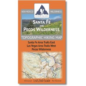 Santa Fe and Pecos Wilderness - New Mexico Hiking (2023)
KWD 4.500
Santa Fe and Pecos Wilderness - New Mexico Hiking (2023)
KWD 4.500
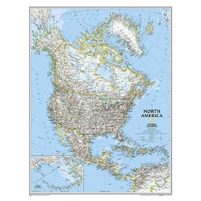 National Geographic North America Wall Map - Classic - Laminated (23.5 x 30.25 in) (National Geographic Reference Map)
KWD 10.500
National Geographic North America Wall Map - Classic - Laminated (23.5 x 30.25 in) (National Geographic Reference Map)
KWD 10.500
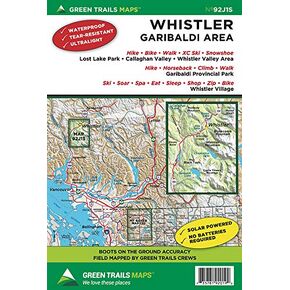 Whistler, BC Canada No. 92J1S (Green Trails Maps)
KWD 5.500
Whistler, BC Canada No. 92J1S (Green Trails Maps)
KWD 5.500