- Shopping, made easy.
- /
- Get the app!
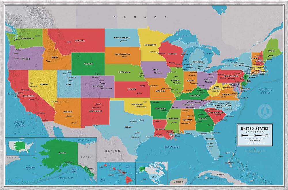
South of Kings United States Scholar Map
Designed and Printed at the Map Shop in Charlotte, NC
The Map Shop's goal is simple. We want to inspire adventure, connect customers to past memories, and offer a better understanding of our world.
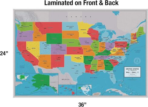
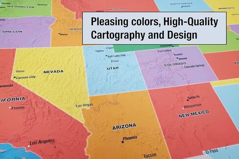
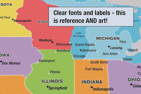
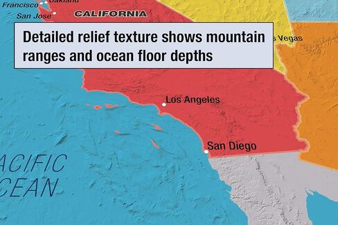
We developed this 36” x 24” U.S. Scholar Map in-house so we'd have complete control over the cartography and design of the map. The result is a map that is as much fine art as it is a geographic reference. The color palette, font families, and graphic elements elevate the look of this map beyond all others.
The United States Scholar Map features a bright blue marine color (oceans, lakes, and rivers) and a fun primary color scheme for the countries. This classic style will look great in home, and school environments.
Clear, large, and easy-to-read labels make this perfect for educational uses in elementary schools or home schools. States, capitals, other major cities, and marine areas are labeled. Accuracy is our first priority and our maps are always up-to-date with the recent geographic changes and we're constantly updating the data.
This map is laminated and is shipped in a cardboard tube. It is NOT folded so there are NO creases in the map.
We have several different style of our world maps available so be sure to check out the other titles as well.
We're a family-run small-business and we sincerely appreciate you being our customer!
How is my order shipped?
Maps are shipped rolled, not folded.
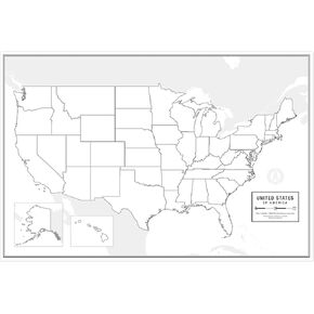 Large Blank United States Outline Map Poster, Laminated, 36" x 24" | Great Blank Wall Map for Classroom or Home Study | Free Dry Erase Marker Included | Includes Detailed Laminated Answer Sheet
KWD 11.500
Large Blank United States Outline Map Poster, Laminated, 36" x 24" | Great Blank Wall Map for Classroom or Home Study | Free Dry Erase Marker Included | Includes Detailed Laminated Answer Sheet
KWD 11.500
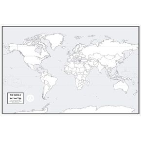 Large Blank World Outline Map Poster, Laminated, 36" x 24" | Great Blank Wall Map for Classroom or Home Study | Free Dry Erase Marker Included | Includes Detailed Laminated Answer Sheet | Learn Fast!
KWD 11.500
Large Blank World Outline Map Poster, Laminated, 36" x 24" | Great Blank Wall Map for Classroom or Home Study | Free Dry Erase Marker Included | Includes Detailed Laminated Answer Sheet | Learn Fast!
KWD 11.500
 Gall Orthographic World Map | Most Accurate World Map - Countries are Shown in Correct Proportion to Each Other | Laminated World Map | 36" x 24"
KWD 12.500
Gall Orthographic World Map | Most Accurate World Map - Countries are Shown in Correct Proportion to Each Other | Laminated World Map | 36" x 24"
KWD 12.500
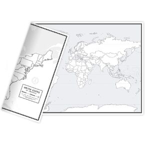 Educational Blank Outline Maps, 2-Sided World & US, 17" x 11", 50-Pack | Great Blank Map Worksheets for Classroom or Home Study | Laminated Answer Sheet Included | Map Packs are Perfect Desk Size
KWD 12.500
Educational Blank Outline Maps, 2-Sided World & US, 17" x 11", 50-Pack | Great Blank Map Worksheets for Classroom or Home Study | Laminated Answer Sheet Included | Map Packs are Perfect Desk Size
KWD 12.500