- Shopping, made easy.
- /
- Get the app!
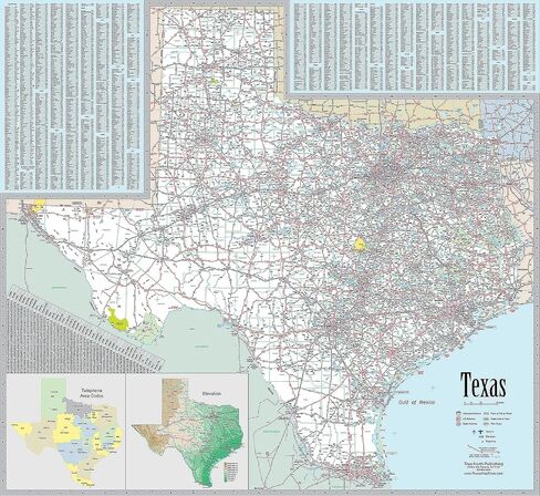
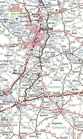
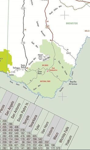
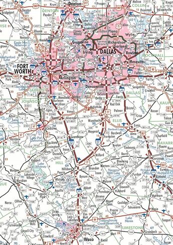
This fully indexed and highly detailed map is ideally sized (42" x 39") making it perfectly readable, yet small enough to be incorporated into most any existing wall space. Includes all state, US and Interstate highways, cities & towns, airports, elevations, rivers, lakes, parks and county names and boundaries. Also included are inset maps of telephone area codes and statewide elevation contours and a mileage chart.
 35 Year AA Medallion Metallic Mandarin Red Tri-Plate Sobriety Chip
KWD 6
35 Year AA Medallion Metallic Mandarin Red Tri-Plate Sobriety Chip
KWD 6
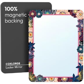 COXLORGB Locker Mirror Magnetic for Girls and School Locker, Strong Magnetic Mirror for Locker, Magnet Mirror for Locker, Locker Accessories, 1 Pack, 5 inxh x 7 inch
KWD 3.500
COXLORGB Locker Mirror Magnetic for Girls and School Locker, Strong Magnetic Mirror for Locker, Magnet Mirror for Locker, Locker Accessories, 1 Pack, 5 inxh x 7 inch
KWD 3.500
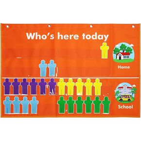 Classroom Attendance Chart Helping Hands Pocket Chart,Durable Classroom Management Pocket Chart for for Classroom,Homeschool,Preschool Supplies
KWD 5.500
Classroom Attendance Chart Helping Hands Pocket Chart,Durable Classroom Management Pocket Chart for for Classroom,Homeschool,Preschool Supplies
KWD 5.500
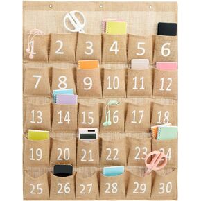 Juvale 30-Row Burlap Cell Phone Holder for Classroom, Farmhouse Designed White Numbered Hanging Pocket Organizer for Mobile Phones, Calculator Caddy, Organization (23x31 in)
KWD 8
Juvale 30-Row Burlap Cell Phone Holder for Classroom, Farmhouse Designed White Numbered Hanging Pocket Organizer for Mobile Phones, Calculator Caddy, Organization (23x31 in)
KWD 8