- Shopping, made easy.
- /
- Get the app!
This USA Wall Map is beautifully illustrated with subtle earth tone hues. The detail is highly legible with state borders clearly defined. In classic Physical Atlas style, this map can be used for general reference, to track current events, or as a piece of art. Sized large at 72"W x 40"H this map is printed on 36lb heavy coated bond using HP 100 year ink. If you select the laminated version we laminate it front and back using a 5ml glossy laminate making it perfect for dry erase marker use. Featuring shaded relief, which combines shading techniques with elevation tints, the mountains, highlands and valleys are immediately obvious. Other map features include Cities, Capitols, Highways, Lakes and Rivers, Longitude and Latitude Lines, Ocean Relief and Points of Interest. Other features include an inset chart of Population and Land Area taken from the 2020 Census as well as a handy distance chart. Perfect for any office conference room, school or home office, this map will stand out. Decorative and functional, this map works anywhere.
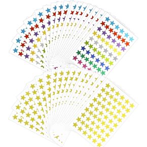 1800 PCS Gold Star Stickers, 30 Sheets Holographic Gold Star Stickers for Kids Reward, Foil Star Stickers, Small Star Sticker for School Planner,Behavior Chart, Classroom Teacher Supplies
KWD 2
1800 PCS Gold Star Stickers, 30 Sheets Holographic Gold Star Stickers for Kids Reward, Foil Star Stickers, Small Star Sticker for School Planner,Behavior Chart, Classroom Teacher Supplies
KWD 2
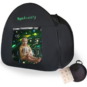 ByeAnxiety Sensory Tent for Kids with Autism - 47x47in Sensory Calm Corner Helps Autism, ADHD, SPD Children Adults Relax, Improve Focus Collapsible Autistic Sensory Play Tents with Bag & Window
KWD 30
ByeAnxiety Sensory Tent for Kids with Autism - 47x47in Sensory Calm Corner Helps Autism, ADHD, SPD Children Adults Relax, Improve Focus Collapsible Autistic Sensory Play Tents with Bag & Window
KWD 30
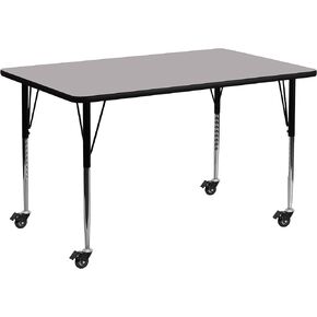 Flash Furniture Mobile 30''W x 72''L Rectangular Grey Thermal Laminate Activity Table - Standard Height Adjustable Legs
KWD 74.500
Flash Furniture Mobile 30''W x 72''L Rectangular Grey Thermal Laminate Activity Table - Standard Height Adjustable Legs
KWD 74.500
 -17%
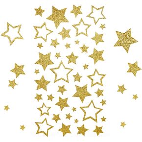
KESOTE 5 Sheets Glitter Gold Star Stickers, Self-Adhesive Assorted Star Labels for Handicrafts Christmas Decoration, Classroom Teacher Supplies
KWD 2.500
-17%
KESOTE 5 Sheets Glitter Gold Star Stickers, Self-Adhesive Assorted Star Labels for Handicrafts Christmas Decoration, Classroom Teacher Supplies
KWD 2.500


