Explore Tennessee, Alabama and Georgia with this physical map! Uncover capital cities, size, population, largest cities, airports, highways, boundaries, and population centers of each state. Tennessee is the 36th-largest state, it is divided into East, Middle, and West Tennessee with Nashville being the capital and the largest city of the state.
Explore the Yellowhammer State, Alabama and the "Heart of Dixie", with the Tennessee, Alabama and Georgia Physical State Map.From the state flower of the Camellia to the capital city of Montgomery, there's so much to discover. In Georgia, dive into Atlanta and other metropolitan hotspots like Augusta, Savannah, Columbus and Macon.
Experience the rustic charm of the Appalachians and the Gulf Coast. With the Tennessee, Alabama and Georgia Physical State Map, explore the very best that the South has to offer!
Size - 23.3 x 16.5 Inches
Printed onto a high quality paper and laminated for durability.
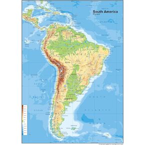 South America Physical Poster Map - 23.3 x 16.5 Inches - Paper Laminated
KWD 10.500
South America Physical Poster Map - 23.3 x 16.5 Inches - Paper Laminated
KWD 10.500
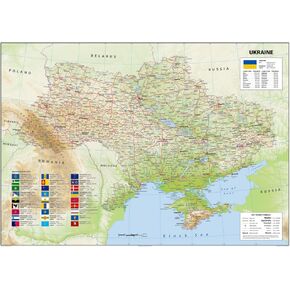 Ukraine Physical Poster Map - 23.3 x 33.1 Inches - Paper Laminated
KWD 14
Ukraine Physical Poster Map - 23.3 x 33.1 Inches - Paper Laminated
KWD 14
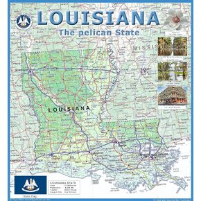 Louisiana Physical Poster Map - 24 x 24 inches - Paper Laminated
KWD 14
Louisiana Physical Poster Map - 24 x 24 inches - Paper Laminated
KWD 14
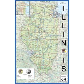 Illinois Physical State Poster Map - 15.1 x 23.3 Inches - Paper Laminated
KWD 10.500
Illinois Physical State Poster Map - 15.1 x 23.3 Inches - Paper Laminated
KWD 10.500


