- Shopping, made easy.
- /
- Get the app!
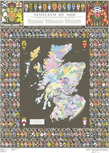
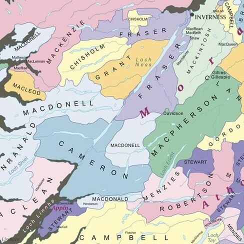
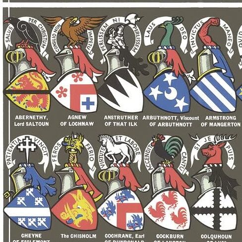
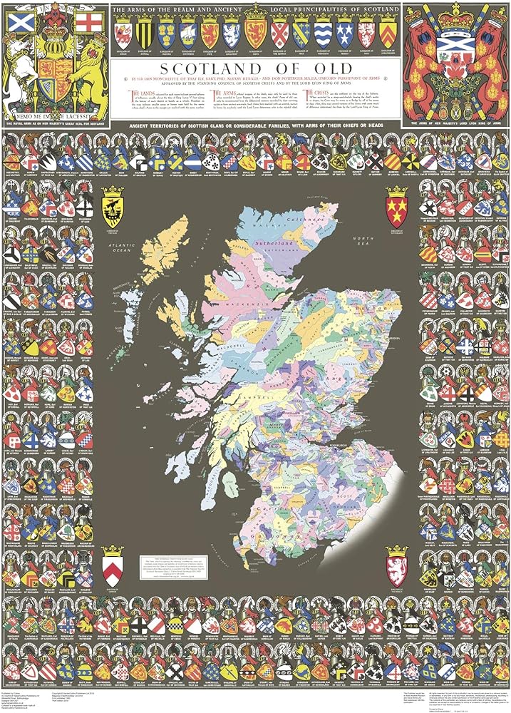
The Collins 'Scotland of Old Clans Map' is a unique pictorial map showing the ancient territories of the principal Scottish clans from the 17th century, and it features Don Pottinger's (Islay Herald of Arms) distinctive and original artwork of Scottish arms and crest badges.
The map includes:
- Over 170 arms, the official insignia of clan chiefs, and crest badges.
- Territories map of principal clans at the beginning of the 17th century.
- Arms of the ancient Scottish principalities.
- Locations of the ancient territories held by the clans around the time of King James VI.
The map is ideal for those with an interest in Scottish heraldry, clans and family history. The map is based on the originally conceived map of the time and is illustrated by the late Sir Iain Moncreiffe of that Ilk, Bart., C.V.O., Q.C., Ph.D., Albany Herald of Arms, and the late Don Pottinger, C.V.O., M.A., D.A., Islay Herald of Arms.
Your laminated map has a glossy finish so that you can use dry erase markers on the map to highlight features, make plans, and share unique information with others. Lamination is also extremely durable, resistant to folding or ripping. Your map is rolled and packaged in a sturdy tube to protect it during shipment.