Ohio, the 34th-largest of the fifty United States, boasts a population of approximately 11.8 million citizens, making it the seventh-most populous. Its largest city is Columbus, with other metropolitan areas of note being Cleveland, Cincinnati, Dayton, Akron, and Toledo.
Aptly nicknamed the "Buckeye State" for its buckeye trees, Ohio is bordered by Lake Erie to the north, Pennsylvania to the east, West Virginia to the southeast, Kentucky to the southwest, Indiana to the west, and Michigan to the northwest. Ohioans are well-known as "Buckeyes", and the state is a source of great pride.
With an Ohio Physical State Map in hand, you'll be well-equipped to explore the Buckeye State's fascinating history and geography. From its storied Great Lakes coastline to its sprawling capital city Columbus, the map helps bring Ohio's wonders to life. Travelers, historians, and nature enthusiasts alike will find the map to be an invaluable resource.
Size - 21.2 x 23.3 Inches
Printed onto high-quality paper and laminated for durability.
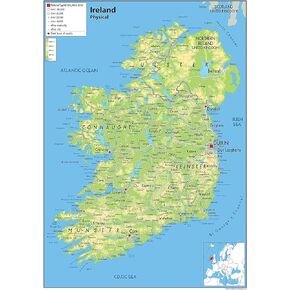 Ireland Physical Poster Map - 16.5 x 23.3 inches - Paper Laminated
KWD 10.500
Ireland Physical Poster Map - 16.5 x 23.3 inches - Paper Laminated
KWD 10.500
 United Kingdom of Great Britain and Northern Ireland Poster Map - 16.5 x 23.3 inches - Paper Laminated
KWD 11
United Kingdom of Great Britain and Northern Ireland Poster Map - 16.5 x 23.3 inches - Paper Laminated
KWD 11
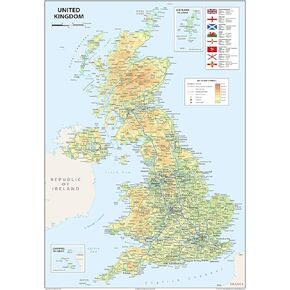
 Physical United Kingdom Poster Map - 16.5 x 23.3 inches - Paper Laminated
KWD 10.500
Physical United Kingdom Poster Map - 16.5 x 23.3 inches - Paper Laminated
KWD 10.500
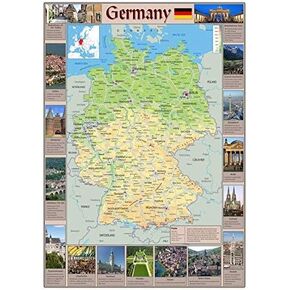 Pictorial Poster Map of Germany - 23.4 x 16.5 inches - Paper Laminated
KWD 10.500
Pictorial Poster Map of Germany - 23.4 x 16.5 inches - Paper Laminated
KWD 10.500


