- Shopping, made easy.
- /
- Get the app!
Scotland encompasses nearly one-third of the nation's landmass, comprising the northern expanse of the isle of Great Britain and over 790 offshore islands, namely the Hebrides' and Northern Isles' archipelagos. Three regions shape the Scottish mainland: the Highlands, a mountainous terrain in the north and northwest; the Lowlands, a flat plain in the center; and the Southern Uplands, a hilly region in the south. Our Physical Map captures its beauty, featuring clear text, and details such as capital cities, rivers, major roads, and surrounding water. It's perfect for any room, office, or school.
Size - 16.5 x 23.5 inches.
Printed onto paper and finished with a durable laminate gloss.
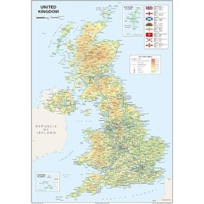 United Kingdom of Great Britain and Northern Ireland Poster Map - 16.5 x 23.3 inches - Paper Laminated
KWD 11
United Kingdom of Great Britain and Northern Ireland Poster Map - 16.5 x 23.3 inches - Paper Laminated
KWD 11
 Physical United Kingdom Poster Map - 16.5 x 23.3 inches - Paper Laminated
KWD 10.500
Physical United Kingdom Poster Map - 16.5 x 23.3 inches - Paper Laminated
KWD 10.500
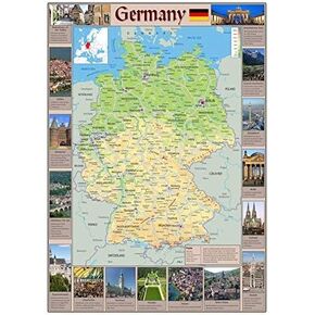 Pictorial Poster Map of Germany - 23.4 x 16.5 inches - Paper Laminated
KWD 10.500
Pictorial Poster Map of Germany - 23.4 x 16.5 inches - Paper Laminated
KWD 10.500
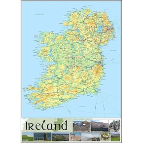 Pictorial Poster Map of Ireland - 23.4 x 16.5 inches - Paper Laminated
KWD 10.500
Pictorial Poster Map of Ireland - 23.4 x 16.5 inches - Paper Laminated
KWD 10.500


