This incredibly-detailed illustrated map of Poland presents the country's physical features, including city names, bodies of water, and images of popular travel spots such as Ojców National Park, Wawel Castle, and Zakopane. With its crystal-clear text and bright colors, it's a snap to read. Perfect for anyone looking to roam through Poland, grasp the nation's geography, or trace their familial ancestry!
Size - 23.4 x 16.5 inches.
Printed on high quality paper which is then finished with a durable gloss laminate.
 United Kingdom of Great Britain and Northern Ireland Poster Map - 16.5 x 23.3 inches - Paper Laminated
KWD 11
United Kingdom of Great Britain and Northern Ireland Poster Map - 16.5 x 23.3 inches - Paper Laminated
KWD 11
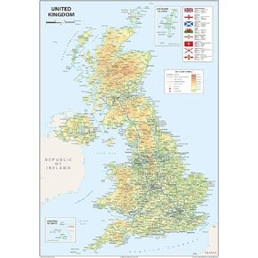
 Physical United Kingdom Poster Map - 16.5 x 23.3 inches - Paper Laminated
KWD 10.500
Physical United Kingdom Poster Map - 16.5 x 23.3 inches - Paper Laminated
KWD 10.500
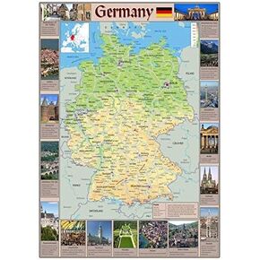 Pictorial Poster Map of Germany - 23.4 x 16.5 inches - Paper Laminated
KWD 10.500
Pictorial Poster Map of Germany - 23.4 x 16.5 inches - Paper Laminated
KWD 10.500
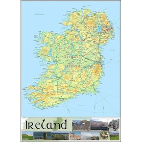 Pictorial Poster Map of Ireland - 23.4 x 16.5 inches - Paper Laminated
KWD 10.500
Pictorial Poster Map of Ireland - 23.4 x 16.5 inches - Paper Laminated
KWD 10.500


