Discover the marvels of the American Southwest with this detailed & informative physical map of Utah & Colorado. With key map details like capital cities, population, area size, and biggest cities like Salt Lake, Lakewood, Boulder, Denver, and West Valley, you'll be able to easily explore state boundaries, major highways, airports, and more.
Plus, don't forget about the breathtaking, geological features like the Great Salt Lake, Uinta Mountains, the Colorado Plateau, and many national parks! See the terrain come alive with physical features like mountain ranges, riverways, lakes, and deserts. With so much to explore, you'll be ready to experience breathtaking natural wonders and uncover the history of the Southwest in an unforgettable way.
Size - 23.3 x 16.5 Inches
Printed onto a high quality paper and laminated for durability.
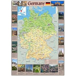 Pictorial Poster Map of Germany - 23.4 x 16.5 inches - Paper Laminated
KWD 10.500
Pictorial Poster Map of Germany - 23.4 x 16.5 inches - Paper Laminated
KWD 10.500
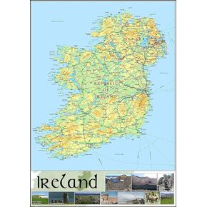 Pictorial Poster Map of Ireland - 23.4 x 16.5 inches - Paper Laminated
KWD 10.500
Pictorial Poster Map of Ireland - 23.4 x 16.5 inches - Paper Laminated
KWD 10.500
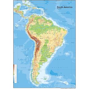 South America Physical Poster Map - 23.3 x 16.5 Inches - Paper Laminated
KWD 10.500
South America Physical Poster Map - 23.3 x 16.5 Inches - Paper Laminated
KWD 10.500
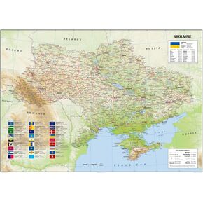 Ukraine Physical Poster Map - 23.3 x 33.1 Inches - Paper Laminated
KWD 14
Ukraine Physical Poster Map - 23.3 x 33.1 Inches - Paper Laminated
KWD 14


