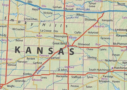
A detailed & informative physical map of the US state Kansas. The key map details include information on capital cities, area size, population and largest city along with locations for airport, major highways, state boundaries and populated areas.
Size - 16.5 x 27.5 Inches.
Printed onto high-quality paper and laminated for durability.
 Physical United Kingdom Poster Map - 16.5 x 23.3 inches - Paper Laminated
KWD 10.500
Physical United Kingdom Poster Map - 16.5 x 23.3 inches - Paper Laminated
KWD 10.500
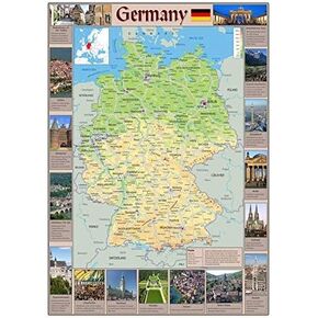 Pictorial Poster Map of Germany - 23.4 x 16.5 inches - Paper Laminated
KWD 10.500
Pictorial Poster Map of Germany - 23.4 x 16.5 inches - Paper Laminated
KWD 10.500
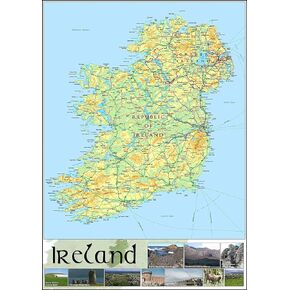 Pictorial Poster Map of Ireland - 23.4 x 16.5 inches - Paper Laminated
KWD 10.500
Pictorial Poster Map of Ireland - 23.4 x 16.5 inches - Paper Laminated
KWD 10.500
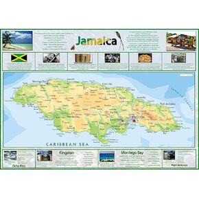 Pictorial Map of Jamaica - 23.4 x 16.5 inches - Paper Laminated
KWD 11
Pictorial Map of Jamaica - 23.4 x 16.5 inches - Paper Laminated
KWD 11