- Shopping, made easy.
- /
- Get the app!
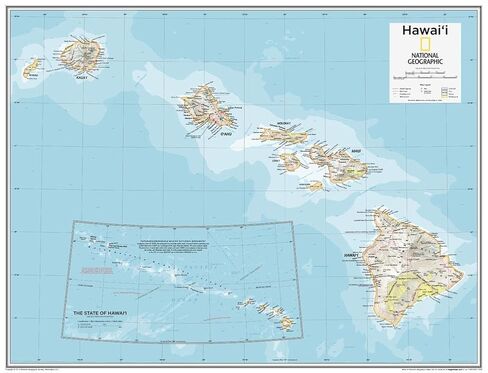
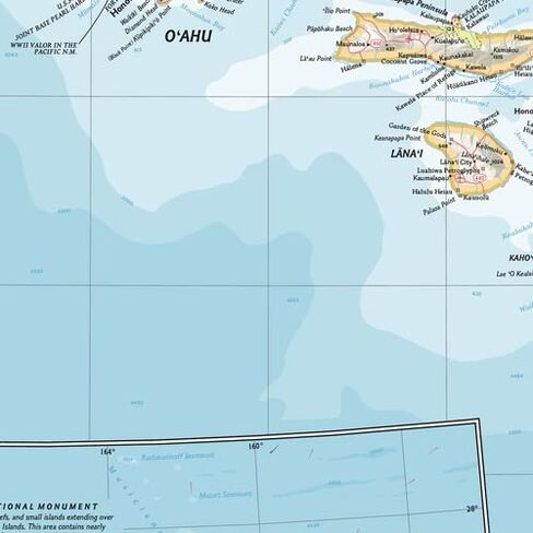
This Hawai'i map of physical and political features can fit in any space. Showcasing the state in stunning detail with state-of-the-art cartographic techniques delivering accuracy and exceptional quality, the innovative and engaging design makes the content easily accessible and user-friendly.
Ideal for classrooms with an emphasis on teaching geography or environmental themes. Physical maps give your students a genuine feel for how our world appears.
This map uses a bright, easy to read color palette featuring blue oceans and stunning shaded relief that has been featured on National Geographic wall maps for over 75 years. It is drawn in the Oblique Mercator projection, which is a cylindrical map projection for nautical navigation because it represents lines of constant course.
National Geographic's maps are the standard by which all other reference maps are measured. The maps are meticulously researched and adhere to National Geographic's convention of making independent, apolitical decisions based on extensive research using multiple authoritative sources.
This map is found in National Geographic's 10th Edition World Atlas, published to mark the 100th anniversary of National Geographic Cartography, and is now available as a stand alone product.
Your laminated map has a glossy finish so that you can use dry erase markers on the map to highlight features, make plans, and share unique information with others. Lamination is also extremely durable, resistant to folding or ripping. Your map is rolled and packaged in a sturdy tube to protect it during shipment.
 National Geographic Maps: United States Contemporary Wall Map - Compact - 23.25 x 16 inches
KWD 5
National Geographic Maps: United States Contemporary Wall Map - Compact - 23.25 x 16 inches
KWD 5
 National Geographic Maps: Middle East Wall Map - Compact - 21.5 x 16.25 inches - Front Lamination
KWD 7.500
National Geographic Maps: Middle East Wall Map - Compact - 21.5 x 16.25 inches - Front Lamination
KWD 7.500
 -6%
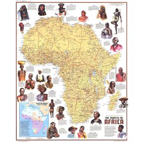
National Geographic: Peoples of Africa 1971 - Historic Wall Map Series - 24.5 x 22.5 - Laminated
KWD 16.500
-6%
National Geographic: Peoples of Africa 1971 - Historic Wall Map Series - 24.5 x 22.5 - Laminated
KWD 16.500
 -21%
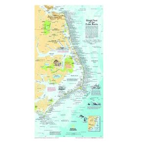
National Geographic: Ghost Fleet of the Outer Banks 1970 Map - Historic Wall Map Series - 11.75 x 21.25 inches - Rolled Canvas
KWD 16.500
-21%
National Geographic: Ghost Fleet of the Outer Banks 1970 Map - Historic Wall Map Series - 11.75 x 21.25 inches - Rolled Canvas
KWD 16.500