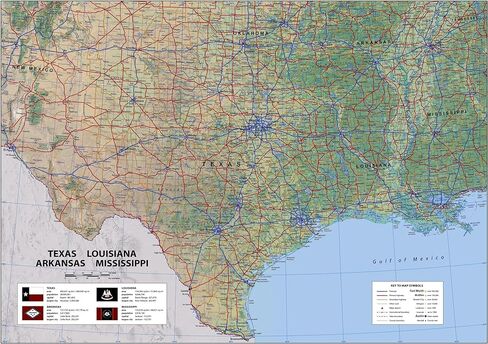
Covering Texas, Louisiana, Arkansas and Mississippi, this map captures all major and minor cities, counties, state lines, and boundaries, as well as state parks, attractions, highways, airports, rivers, and lakes. Texas, the second-largest state in size and population, is located in the South Central region of the U.S. Louisiana, with 4.6 million residents, is the only state in the U.S. with parishes in addition to counties.
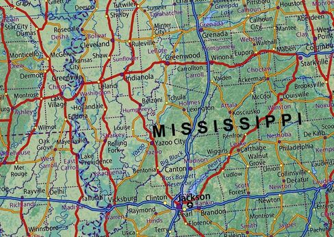
Arkansas is landlocked in the South Central region. With 3 million people, its capital is Little Rock. And Mississippi, bordering Tennessee, Alabama, Louisiana, and Arkansas, is situated in the Southeastern U.S. Its capital is Jackson and its most populated metro area is Greater Jackson, with 591,978 people.
This map is the perfect way to explore the geography and culture of each state, giving you a comprehensive view of the region. It's perfect for any traveler, student, or geography enthusiast!
Size - 23.3 x 16.5 Inches
Printed onto a high quality paper and laminated for durability.
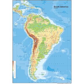 South America Physical Poster Map - 23.3 x 16.5 Inches - Paper Laminated
KWD 10.500
South America Physical Poster Map - 23.3 x 16.5 Inches - Paper Laminated
KWD 10.500
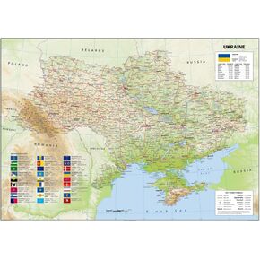 Ukraine Physical Poster Map - 23.3 x 33.1 Inches - Paper Laminated
KWD 14
Ukraine Physical Poster Map - 23.3 x 33.1 Inches - Paper Laminated
KWD 14
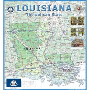 Louisiana Physical Poster Map - 24 x 24 inches - Paper Laminated
KWD 14
Louisiana Physical Poster Map - 24 x 24 inches - Paper Laminated
KWD 14
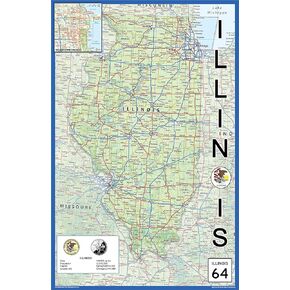 Illinois Physical State Poster Map - 15.1 x 23.3 Inches - Paper Laminated
KWD 10.500
Illinois Physical State Poster Map - 15.1 x 23.3 Inches - Paper Laminated
KWD 10.500