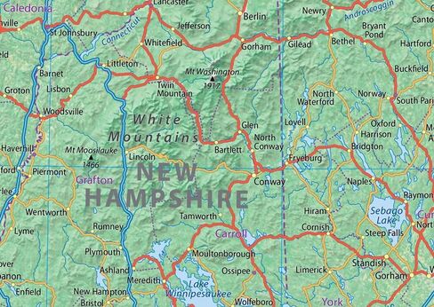
Our Physical state map of New England includes six states in the Northeast US: Maine, Vermont, New Hampshire, Massachusetts, Rhode Island, and Connecticut. With cities such as Boston, Worcester, Providence, Springfield, Massachusetts, Manchester, New Hampshire, Providence, Rhode Island, Bridgeport, New Haven, and Stamford, New England is bordered to the west by the state of New York and features the northern reach of the Appalachian Mountains and multiple rivers, including the Connecticut River.
This physical map of New England captures the region's diverse landscape. With its clear text, the map provides a truly immersive experience in exploring and appreciating the beauty of this historic corner of the US. It's perfect for any room, office, or school, and a great way to gain a comprehensive view of the State!
Size 24 x 17 inches.
Printed onto high-quality paper and laminated for durability.
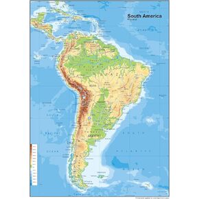 South America Physical Poster Map - 23.3 x 16.5 Inches - Paper Laminated
KWD 10.500
South America Physical Poster Map - 23.3 x 16.5 Inches - Paper Laminated
KWD 10.500
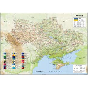 Ukraine Physical Poster Map - 23.3 x 33.1 Inches - Paper Laminated
KWD 14
Ukraine Physical Poster Map - 23.3 x 33.1 Inches - Paper Laminated
KWD 14
 Louisiana Physical Poster Map - 24 x 24 inches - Paper Laminated
KWD 14
Louisiana Physical Poster Map - 24 x 24 inches - Paper Laminated
KWD 14
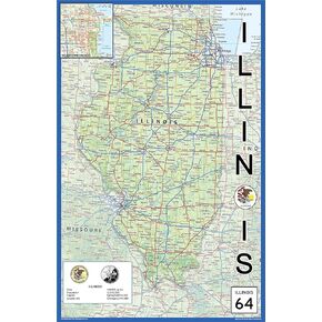 Illinois Physical State Poster Map - 15.1 x 23.3 Inches - Paper Laminated
KWD 10.500
Illinois Physical State Poster Map - 15.1 x 23.3 Inches - Paper Laminated
KWD 10.500