- Shopping, made easy.
- /
- Get the app!
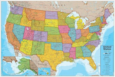
Introducing Waypoint Geographic's multicolor USA Map Wall Chart, a visually distinctive and informative map featuring gray shading to highlight different land formations across the continent. Enhancing the learning experience, our interactive Augmented and Virtual Reality app brings the map to life with 4D animations, educational games, and captivating videos suitable for students of all ages. Compatible with the latest iPhone/iPad, Android smartphones, or tablets, the app ensures limitless fun learning possibilities. This informative wall map poster showcases USA states, capitals, neighboring countries, statistics, and bodies of water coordinates, making it a remarkable tool for exploring and studying the USA. Measuring 24” W x 30” L, this laminated wall art is an excellent addition to homes, classrooms, and childcare centers, serving as a valuable geography learning resource for elementary, middle, and high school students. Moreover, it is a thoughtful gift idea for adventure enthusiasts, making it a memorable present for birthdays, graduations, or any other occasion that sparks wanderlust.
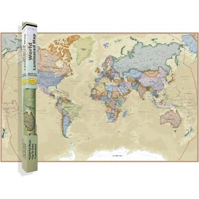 Waypoint Geographic Contemporary Series World Wall Map, Laminated World Map Poster, Educational Wall Art For Home, Classroom, or Office, Unique Gifts, 24" x 36"
KWD 11
Waypoint Geographic Contemporary Series World Wall Map, Laminated World Map Poster, Educational Wall Art For Home, Classroom, or Office, Unique Gifts, 24" x 36"
KWD 11
 Classroom Dissection Set
KWD 55.500
Classroom Dissection Set
KWD 55.500
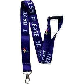 Autism Awareness - Please Be Patient i Have Autism - Neck Lanyard with Safety Break Away - Adult Size
KWD 5
Autism Awareness - Please Be Patient i Have Autism - Neck Lanyard with Safety Break Away - Adult Size
KWD 5
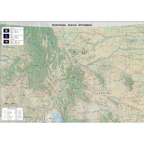 Montana, Idaho and Wyoming Physical Poster Map - 16.5 x 23.3 Inches - Paper Laminated
KWD 14
Montana, Idaho and Wyoming Physical Poster Map - 16.5 x 23.3 Inches - Paper Laminated
KWD 14
