- Shopping, made easy.
- /
- Get the app!
Own a piece of 20th century history with this vintage map!
A historic snapshot of a region in turmoil, this map was called "The New Geographic War Map" by National Geographic in July 1915, barely one year into the First World War. "Never before has there been such a demand for maps of any part of the globe as there is today for maps of Europe."
This gorgeous early-century map boldly outlines the international borders that would soon change once the "war to end all wars" had finally come to its blood-soaked conclusion. Explore the region where it all began - the Austro-Hungrian Empire - and other remnants of pre-20th century political systems, such as the powerful Ottoman Empire and pre-Soviet Russia.
An inset of the Dardenelles offers a close-up view of the region of the Gallipoli Campaign under Winston Churchill against the Ottoman Empire. At the time of this map's publication, the battle that would end in tragic defeat of the Allies was still underway.
A must-have for map collectors and history buffs interested in military history, and particularly The Great War. The perfect companion to Map of Europe Showing the Countries Established by the Peace Conference of Paris. Explore how WWI changed the European political landscape!
Printed on high quality thick paper strong enough for display on your wall.
Your map is rolled and packaged in a sturdy tube to protect it during shipment.
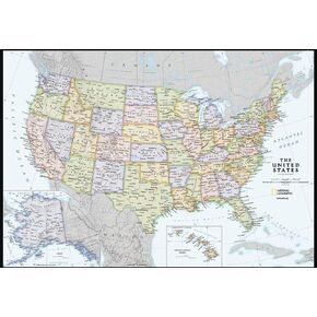 National Geographic Maps: United States Contemporary Wall Map - Compact - 23.25 x 16 inches
KWD 5
National Geographic Maps: United States Contemporary Wall Map - Compact - 23.25 x 16 inches
KWD 5
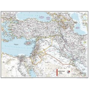 National Geographic Maps: Middle East Wall Map - Compact - 21.5 x 16.25 inches - Front Lamination
KWD 7.500
National Geographic Maps: Middle East Wall Map - Compact - 21.5 x 16.25 inches - Front Lamination
KWD 7.500
 -6%
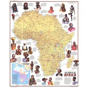
National Geographic: Peoples of Africa 1971 - Historic Wall Map Series - 24.5 x 22.5 - Laminated
KWD 16.500
-6%
National Geographic: Peoples of Africa 1971 - Historic Wall Map Series - 24.5 x 22.5 - Laminated
KWD 16.500
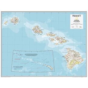 National Geographic Maps: Hawai'i Wall Map - Compact - 21 x 16 inches - Front Lamination
KWD 9.500
National Geographic Maps: Hawai'i Wall Map - Compact - 21 x 16 inches - Front Lamination
KWD 9.500


