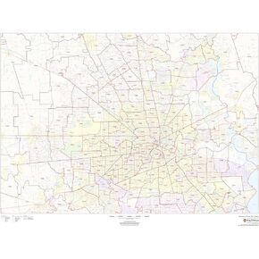
48 x 36 inches. Laminated. Flat map, tubed for shipping.
This map of Harris County, Texas shows regional level information. Base map features include highways and major roads with labelling; railways; high level land use such as parks and recreation areas; and a selection of points of interest including transportation hubs like airports and train stations, tourist information and police stations. ZIP code boundaries are shown as a secondary map feature.
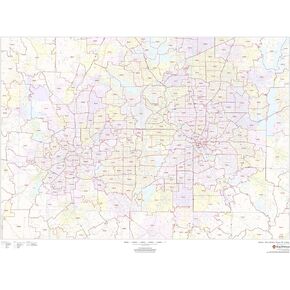
Scale 1:95,000
Description
48 x 36 inches. Laminated. Flat map, tubed for shipping.
This map of Harris County, Texas shows regional level information. Base map features include highways and major roads with labelling; railways; high level land use such as parks and recreation areas; and a selection of points of interest including transportation hubs like airports and train stations, tourist information and police stations. ZIP code boundaries are shown as a secondary map feature.