- Shopping, made easy.
- /
- Get the app!
This is a large, highly detailed map of Massachusetts with all cities and towns, National Parks and National Forests, main roads and highways, major waterways, state boundaries and populated areas. This Massachusetts Map is designed to be a convenient reference for all in Massachusetts.
Size - 23.3 x 16.5 Inches.
Printed onto high quality poster paper and laminated for extra durability.
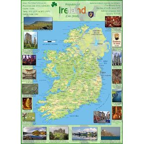 Pictorial Poster Map of Ireland - 23.4 x 16.5 inches - Paper Laminated
KWD 10.500
Pictorial Poster Map of Ireland - 23.4 x 16.5 inches - Paper Laminated
KWD 10.500
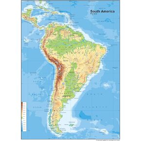 South America Physical Poster Map - 23.3 x 16.5 Inches - Paper Laminated
KWD 10.500
South America Physical Poster Map - 23.3 x 16.5 Inches - Paper Laminated
KWD 10.500
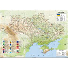 Ukraine Physical Poster Map - 23.3 x 33.1 Inches - Paper Laminated
KWD 14
Ukraine Physical Poster Map - 23.3 x 33.1 Inches - Paper Laminated
KWD 14
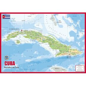 Cuba Physical Poster Map - 23.3 x 16.5 Inches - Paper Laminated
KWD 10.500
Cuba Physical Poster Map - 23.3 x 16.5 Inches - Paper Laminated
KWD 10.500


