- Shopping, made easy.
- /
- Get the app!

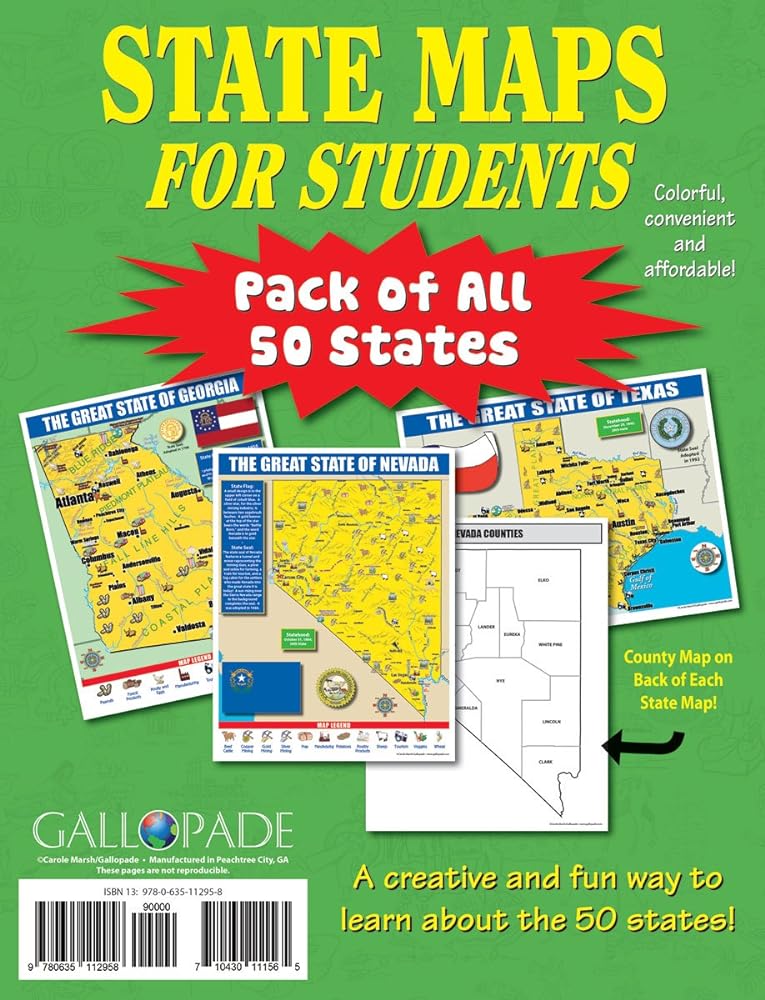
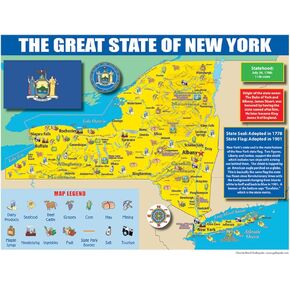
This State Maps for Students is a pack of maps for all 50 states. The State Maps for Students is colorful, convenient and affordable! The State Maps for Students is great for building map literacy. Students will be able to reference the map of that state all year long!
Each map has two sides. Side 1 includes:
A colorful map of that state that includes all the major cities
A map legend that includes where all the major industries are located throughout the state
Origin of the state's name
History of the state flag and image of the flag
The statehood date
The state seal
Side 2 includes:
A black & white image of all of the counties in that state
Each map is 8.5" X 11", printed on glossy, sturdy card stock paper and printed in the U.S.A.
 Ashley Productions ASH10800 Reading Guide Strip, 1.5" Wide, 8.5" Length, 0.05" Height, Yellow
KWD 2
Ashley Productions ASH10800 Reading Guide Strip, 1.5" Wide, 8.5" Length, 0.05" Height, Yellow
KWD 2
 289-LOTM16 16-Tablet/Chromebook Open Charging Cart
KWD 120
289-LOTM16 16-Tablet/Chromebook Open Charging Cart
KWD 120
 -20%
Publishing Group New York State Map for Students - Pack of 30 (9780635106599)
KWD 6
-20%
Publishing Group New York State Map for Students - Pack of 30 (9780635106599)
KWD 6
 Board Book in Russian Language Neurogymnastics, 48 pgs - Read Russian Books - Brain Boosting Exercises for Cognitive Development, Speech Therapy
KWD 11.500
Board Book in Russian Language Neurogymnastics, 48 pgs - Read Russian Books - Brain Boosting Exercises for Cognitive Development, Speech Therapy
KWD 11.500