- Shopping, made easy.
- /
- Get the app!
53.75 x 31.5 inches. Printed on paper. Flat map, tubed for shipping.
Colorful yet informative map. Combined with a detailed political map of the world, contrasting colors are used to accurately depict the different time zones, both on land and in the oceans. Includes an additional map showing countries/states that adopt daylight saving hours.
Scale 1:30,000,000
 Detailed World Coloring Map - Big - 27.75" x 16.25" Laminated
KWD 7
Detailed World Coloring Map - Big - 27.75" x 16.25" Laminated
KWD 7
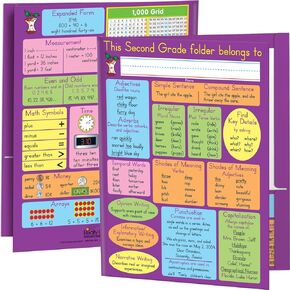 Really Good Stuff Common Core Resource Folders – Second Grade – Set of 12 - Bulk School Supplies, Take Home Organizer for Students, Classroom Essentials
KWD 14.500
Really Good Stuff Common Core Resource Folders – Second Grade – Set of 12 - Bulk School Supplies, Take Home Organizer for Students, Classroom Essentials
KWD 14.500
 -48%
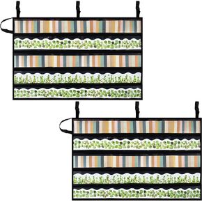
Pack of 2, Bulletin Board Border Storage, Black, 37.5" x 23.8" Unfolded Size - Bulletin Border Storage Pocket Charts for Easy Border Organization, Portable Border Storage Box for Teachers
KWD 8.500
-48%
Pack of 2, Bulletin Board Border Storage, Black, 37.5" x 23.8" Unfolded Size - Bulletin Border Storage Pocket Charts for Easy Border Organization, Portable Border Storage Box for Teachers
KWD 8.500
 -8%
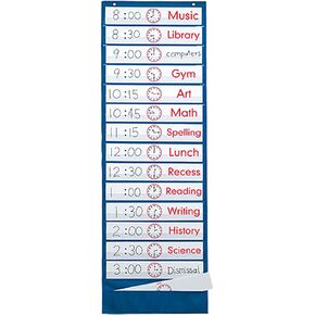
Lauri Scheduling Pocket Chart
KWD 6
-8%
Lauri Scheduling Pocket Chart
KWD 6


