- Shopping, made easy.
- /
- Get the app!
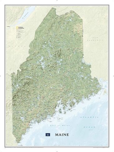
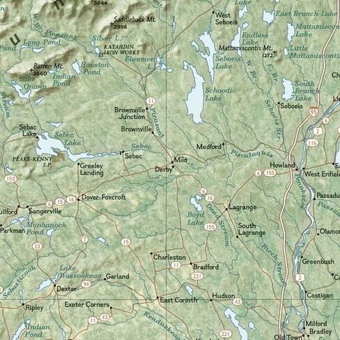
This gorgeous Maine map is a part of National Geographic's series of State Wall Maps. It showcases the state in stunning detail with state-of-the-art cartographic techniques delivering accuracy and exceptional quality, the innovative and engaging design makes the content easily accessible and user-friendly.
Ideal for classrooms with an emphasis on teaching geography or environmental themes. Physical wall maps give your students a genuine feel for how our world appears. This map is perfect to help students develop navigation skills using latitude and longitude and political boundaries.
This map uses a bright, easy to read color palette featuring blue oceans and stunning shaded relief that has been featured on National Geographic wall maps for over 75 years. It is drawn in the Albers Conic Equal-Area projection, which uses two standard parallels between which distortion is minimized.
Names of political and geographic features are carefully placed on the map to maintain legibility. The Maine state flag is attractively included beside the map title, adding a pop of color.
National Geographic's maps are the standard by which all other reference maps are measured. The maps are meticulously researched and adhere to National Geographic's convention of making independent, apolitical decisions based on extensive research using multiple authoritative sources.
Printed on polypropylene, an ideal material for wall maps as the printing brings out rich colours, and crisp edges for readability. The material is stronger than most papers and unlikely to crease or rip. The matte finish eliminates glare, and adds texture to the map. Ideal for display.
Your map is rolled and packaged in a sturdy tube to protect it during shipment.
 National Geographic Maps: United States Contemporary Wall Map - Compact - 23.25 x 16 inches
KWD 5
National Geographic Maps: United States Contemporary Wall Map - Compact - 23.25 x 16 inches
KWD 5
 National Geographic Maps: Middle East Wall Map - Compact - 21.5 x 16.25 inches - Front Lamination
KWD 7.500
National Geographic Maps: Middle East Wall Map - Compact - 21.5 x 16.25 inches - Front Lamination
KWD 7.500
 -6%
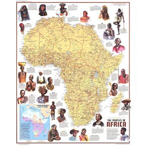
National Geographic: Peoples of Africa 1971 - Historic Wall Map Series - 24.5 x 22.5 - Laminated
KWD 16.500
-6%
National Geographic: Peoples of Africa 1971 - Historic Wall Map Series - 24.5 x 22.5 - Laminated
KWD 16.500
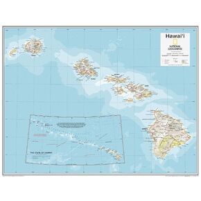 National Geographic Maps: Hawai'i Wall Map - Compact - 21 x 16 inches - Front Lamination
KWD 9.500
National Geographic Maps: Hawai'i Wall Map - Compact - 21 x 16 inches - Front Lamination
KWD 9.500