- Shopping, made easy.
- /
- Get the app!
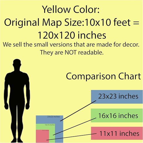
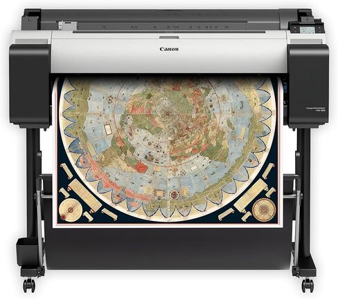
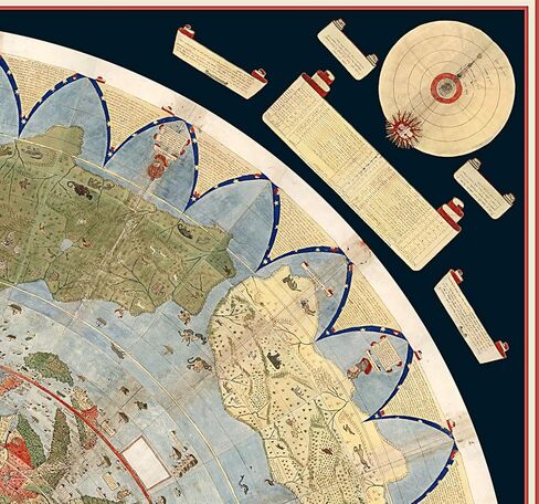
NOTE: This map is originally more than 10 feet by 10 feet when fully assembled and this is a SMALL reproduction. (please look at the close-up pics, the text is really hard to read even with a magnifying glass)
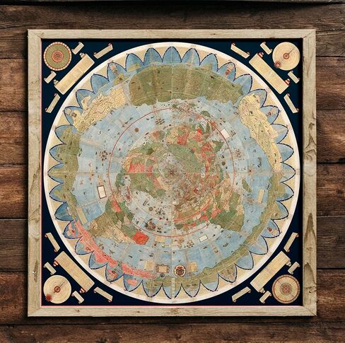
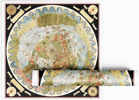
Composite map of the first ring of four sheets around the north pole, the second ring of 8 sheets, the third ring of 12 sheets, the fourth ring of 18 sheets, the fifth ring of 18 sheets, and the legends and diagrams in the four corners.
Urbano Monte's map gives a very detailed and accurate picture of the whole “globe”, although it was made only 95 years after the discovery of America.
For the last 430 years, its 60 individual sheets were bound together as an atlas, but now they have finally been put together—digitally—to reveal a complete picture of the world as it was understood at the time.
The map is packed with fantastical creatures, from unicorns in Siberia to mermen frollicking in the Southern Ocean and a terrifying bird flying off with an elephant in its talons. The map reflects the geographical knowledge (and misconceptions) of its time, but in some ways it's surprisingly advanced. It portrays the Earth as it would be seen looking directly down on the North Pole from space, a perspective not commonly used by mapmakers until the 20th century.
Monte made his map to serve not only as a geographical tool but also to show climate, customs, length of day, distances within regions - in other words, to create a universal scientific planisphere
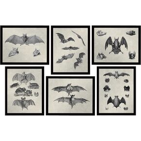 Bat Decor - Gothic Decor - Witchy Gifts Creepy Vampire Wall Art Goth Decorations 6 (8x10) UNFRAMED Prints Poster Skeleton Bats Emo Whimsigoth Dark Academia Victorian Oddities Curiosities Beebeauty
KWD 8
Bat Decor - Gothic Decor - Witchy Gifts Creepy Vampire Wall Art Goth Decorations 6 (8x10) UNFRAMED Prints Poster Skeleton Bats Emo Whimsigoth Dark Academia Victorian Oddities Curiosities Beebeauty
KWD 8
 Feminist Wall Art Decor - Badass Women Empowerment - Witchy Gifts - Gothic Home Decor - 8 (8x10) UNFRAMED Prints - Whimsigoth Goth Wicca Pagan Witchcraft Oddities Curiosities Dark Academia Victorian
KWD 9
Feminist Wall Art Decor - Badass Women Empowerment - Witchy Gifts - Gothic Home Decor - 8 (8x10) UNFRAMED Prints - Whimsigoth Goth Wicca Pagan Witchcraft Oddities Curiosities Dark Academia Victorian
KWD 9
 -11%
Teadokly 2pack Remote Control Holder,Self-Adhesive Wall Mount Phone Holder,Air Conditioner TV Remote Control Bracket,Wall-Mounted Mini Storage Box (1.96inch)
KWD 4
-11%
Teadokly 2pack Remote Control Holder,Self-Adhesive Wall Mount Phone Holder,Air Conditioner TV Remote Control Bracket,Wall-Mounted Mini Storage Box (1.96inch)
KWD 4
 CVHOMEDECO. Primitives Rustic Oval “Bless Our home" Cardboard Nesting Boxes, Large 9-3/4 x 5-1/2 x 4 Inch, Set of 3.
KWD 9.500
CVHOMEDECO. Primitives Rustic Oval “Bless Our home" Cardboard Nesting Boxes, Large 9-3/4 x 5-1/2 x 4 Inch, Set of 3.
KWD 9.500