- Shopping, made easy.
- /
- Get the app!
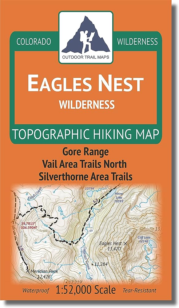
Waterproof, tear-resistant topographic hiking map covering all 165 miles of hiking trails in the Eagles Nest Wilderness area of Central Colorado and an additional 160 miles of trails in the surrounding areas. Showing all of the hiking trails north and east of Vail and west of Silverthorne, this map covers the entire Gore Range.
 Sangre de Cristo Wilderness NORTH - Colorado Topographic Hiking Map (2022)
KWD 4
Sangre de Cristo Wilderness NORTH - Colorado Topographic Hiking Map (2022)
KWD 4
 Rawah Wilderness - Colorado Topographic Hiking Map (2018)
KWD 4
Rawah Wilderness - Colorado Topographic Hiking Map (2018)
KWD 4
 Lizard Head - Mount Sneffels Wilderness - Colorado Topographic Hiking Map (2018)
KWD 4
Lizard Head - Mount Sneffels Wilderness - Colorado Topographic Hiking Map (2018)
KWD 4
 Outdoor Trail Maps Colorado 14ers Series Front-Tenmile-Mosquito Range Map Pack
KWD 9.500
Outdoor Trail Maps Colorado 14ers Series Front-Tenmile-Mosquito Range Map Pack
KWD 9.500