- Shopping, made easy.
- /
- Get the app!
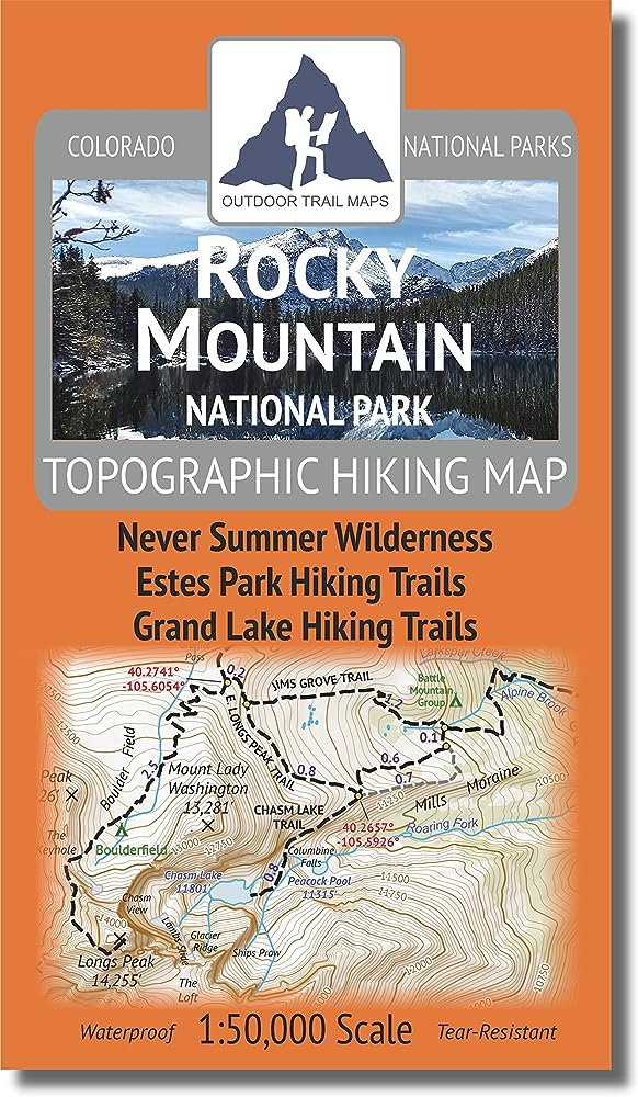
Waterproof, tear-resistant topographic hiking map covering all of the trails in the Rocky Mountain National Park in Colorado as well as the entire Never Summer Wilderness and Bowen Gulch Protection Area. This map is tough and trail-ready for the harshest conditions. Covering some of the popular areas such as Longs Peak, Wild Basin and Glacier Gorge as well as the more remote and less travelled areas of the park, this map is the key to years of discovery along some of the most beautiful hiking trails in Colorado.
 Sangre de Cristo Wilderness NORTH - Colorado Topographic Hiking Map (2022)
KWD 4
Sangre de Cristo Wilderness NORTH - Colorado Topographic Hiking Map (2022)
KWD 4
 Rawah Wilderness - Colorado Topographic Hiking Map (2018)
KWD 4
Rawah Wilderness - Colorado Topographic Hiking Map (2018)
KWD 4
 Lizard Head - Mount Sneffels Wilderness - Colorado Topographic Hiking Map (2018)
KWD 4
Lizard Head - Mount Sneffels Wilderness - Colorado Topographic Hiking Map (2018)
KWD 4
 Outdoor Trail Maps LLC Eagles Nest Wilderness - Colorado Topographic Hiking Map (2018)
KWD 4
Outdoor Trail Maps LLC Eagles Nest Wilderness - Colorado Topographic Hiking Map (2018)
KWD 4