- Shopping, made easy.
- /
- Get the app!
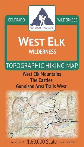
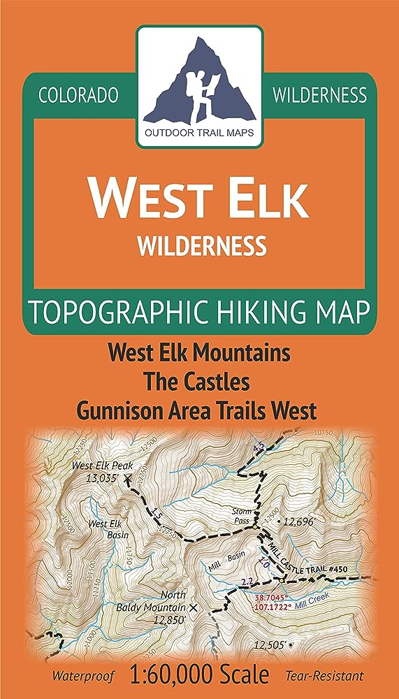
Waterproof, tear-resistant topographic hiking map covering all of the hiking trails in the West Elk Wilderness area of central Colorado west of Gunnison, including the West Elk Mountains in the Gunnison National Forest. The front side of the map covers the eastern portion of the wilderness, including trails southwest of Crested Butte and west of Gunnison. The front also features the Castles and West Elk Peak among others. The back of the map shows the western portion of the wilderness east of Montrose.
 Sangre de Cristo Wilderness NORTH - Colorado Topographic Hiking Map (2022)
KWD 4
Sangre de Cristo Wilderness NORTH - Colorado Topographic Hiking Map (2022)
KWD 4
 Rawah Wilderness - Colorado Topographic Hiking Map (2018)
KWD 4
Rawah Wilderness - Colorado Topographic Hiking Map (2018)
KWD 4
 Lizard Head - Mount Sneffels Wilderness - Colorado Topographic Hiking Map (2018)
KWD 4
Lizard Head - Mount Sneffels Wilderness - Colorado Topographic Hiking Map (2018)
KWD 4
 Outdoor Trail Maps LLC Eagles Nest Wilderness - Colorado Topographic Hiking Map (2018)
KWD 4
Outdoor Trail Maps LLC Eagles Nest Wilderness - Colorado Topographic Hiking Map (2018)
KWD 4