- Shopping, made easy.
- /
- Get the app!
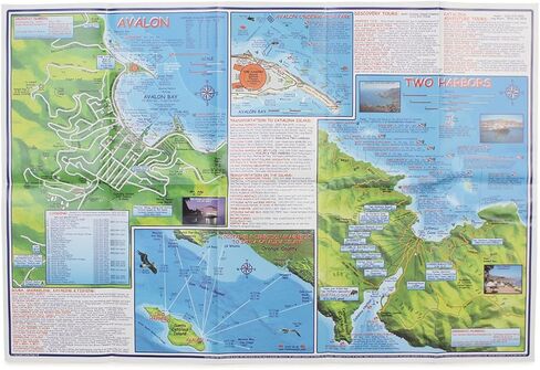
Topographic trail maps for mountain and road cyclists, hikers and equestriansPrinted on durable waterproof synthetic paper using fade resistant inksCA Santa Catalina Guide
 YellowMaps Clanton East AL topo map, 1:24000 Scale, 7.5 X 7.5 Minute, Historical, 1972, Updated 1984, 26.7 x 21.9 in
KWD 12.500
YellowMaps Clanton East AL topo map, 1:24000 Scale, 7.5 X 7.5 Minute, Historical, 1972, Updated 1984, 26.7 x 21.9 in
KWD 12.500
 Lizard Head - Mount Sneffels Wilderness - Colorado Topographic Hiking Map (2018)
KWD 4
Lizard Head - Mount Sneffels Wilderness - Colorado Topographic Hiking Map (2018)
KWD 4
 Beartooth Publishing Wind River Range South, Wyoming Topographic Shaded Relief Outdoor Recreation Map
KWD 8
Beartooth Publishing Wind River Range South, Wyoming Topographic Shaded Relief Outdoor Recreation Map
KWD 8
 YellowMaps Dyas AL topo map, 1:50000 Scale, 15 X 15 Minute, Historical, 2003, 29.1 x 22.1 in
KWD 16.500
YellowMaps Dyas AL topo map, 1:50000 Scale, 15 X 15 Minute, Historical, 2003, 29.1 x 22.1 in
KWD 16.500