- Shopping, made easy.
- /
- Get the app!
USGS topographic map of Mt Shasta, California, dated 1998, updated 2003.
Includes geographic coordinates (latitude and longitude), lines of elevation, bodies of water, roads, and more. This topo quad is suitable for recreational, outdoor uses, office applications, or wall map framing.
Printed on-demand by YellowMaps on the print material of your choice.
Shipping rolled from Minneapolis, MN, United States.
Product Number: USGS-5519257
Map Size: 26.7 inches high x 21.9 inches wide
Map Scale: 1:24000
Map Type: POD USGS Topographic Map
Map Series: HTMC
Map Version: Historical
Cell ID: 30801
Scan ID: 293352
Imprint Year: 2003
Woodland Tint: Yes
Visual Version Number: 1
Aerial Photo Year: 1997
Edit Year: 1998
Datum: NAD27
Map Projection: Lambert Conformal Conic
Map published by United States Geological Survey
Map published by United States Forest Service
Map Language: English
Scanner Resolution: 600 dpi
Map Cell Name: Mount Shasta
Grid size: 7.5 X 7.5 Minute
Date on map: 1998
Geographical region: California, United States
Northern map edge Latitude: 41.5°
Southern map edge Latitude: 41.375°
Western map edge Longitude: -122.25°
Eastern map edge Longitude: -122.125°
Surrounding map sheets (copy & paste the Product No. in the search bar):
North: USGS-5524543,USGS-5524541,USGS-5504775,USGS-5504771,USGS-5524539
East: USGS-5507733,USGS-5507737
South: USGS-5518243,USGS-5518203
West: USGS-5515693,USGS-5515697,USGS-5515695
 Sangre de Cristo Wilderness NORTH - Colorado Topographic Hiking Map (2022)
KWD 4
Sangre de Cristo Wilderness NORTH - Colorado Topographic Hiking Map (2022)
KWD 4
 YellowMaps Clanton East AL topo map, 1:24000 Scale, 7.5 X 7.5 Minute, Historical, 1972, Updated 1984, 26.7 x 21.9 in
KWD 12.500
YellowMaps Clanton East AL topo map, 1:24000 Scale, 7.5 X 7.5 Minute, Historical, 1972, Updated 1984, 26.7 x 21.9 in
KWD 12.500
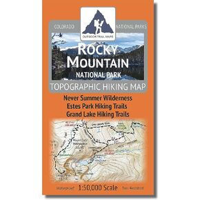 Rocky Mountain National Park - 2021 Topographic Hiking Map
KWD 4.500
Rocky Mountain National Park - 2021 Topographic Hiking Map
KWD 4.500
 Collegiate Peaks Wilderness - Colorado Topographic Hiking Map (2018)
KWD 4
Collegiate Peaks Wilderness - Colorado Topographic Hiking Map (2018)
KWD 4


