- Shopping, made easy.
- /
- Get the app!
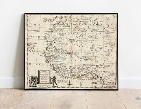
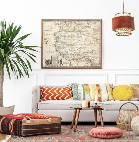
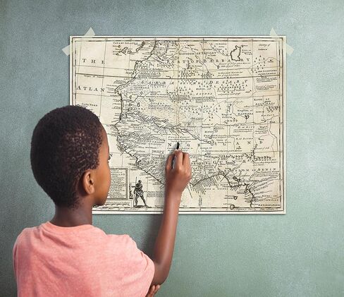
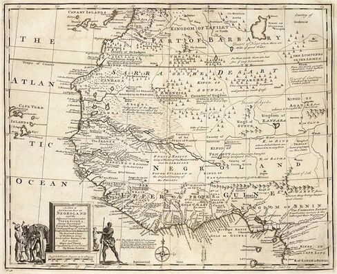
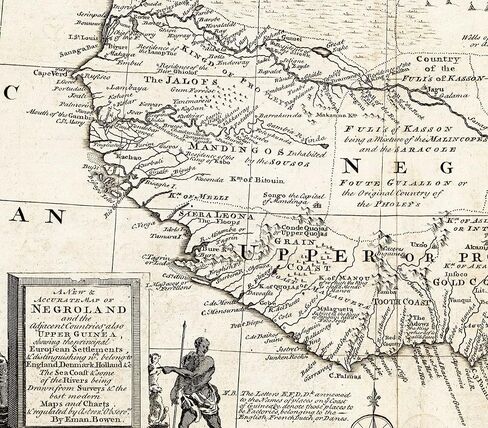
Size: 23"x28". This Map is a historic (and disgraceful) look at how Europeans viewed West Africa and Africans This map of 1747 West African shares information about Western Africa during the slave trade. Negroland, or Nigritia, is an archaic term in European mapping, describing the inland and poorly explored (by Europeans) region in West Africa. This vintage map reproduction shows western Africa and the countries and colonies in Africa where people were kidnapped and traded as slaves. Please be advised that this map is a reproduction, a modern copy of the original. Important Historic Map for all Kids, Adults and Future Generations. Showing the Kingdom of Judah on the West Coast of Africa. Identifies the nationality of the Transatlantic Slaves. A map of Negroland and the adjacent countries; also Upper Guinea, showing the principal European settlements and distinguishing which belong to England, Denmark, Holland. The sea coast & some of the rivers being drawn from surveys. Shows boundaries, rivers and principle settlements, with tents showing areas inhabited by nomads. We love the look of Antique Maps Note: We reproduce antique and vintage maps as they are - Blemishes and all. These might include stains, creases, color variation, rips, uneven edges and signs of aging Many of our customers enjoy the authentic antique look which is what we try to provide. Examine the close-ups and ask questions about our prints.
 GraduationMall Graduation Medallion, Graduation Award Medal with Neck Ribbon, Copper (Zinc Alloy)
KWD 4.500
GraduationMall Graduation Medallion, Graduation Award Medal with Neck Ribbon, Copper (Zinc Alloy)
KWD 4.500
 -41%
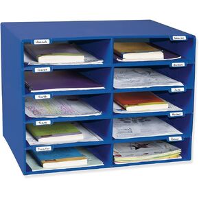
Pacon Classroom Keepers 30-Slot Mailbox, Blue (001318)
KWD 22
-41%
Pacon Classroom Keepers 30-Slot Mailbox, Blue (001318)
KWD 22
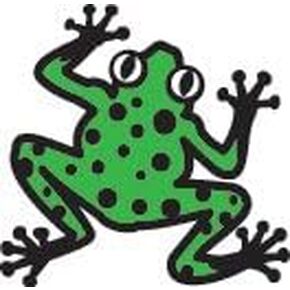 Tree Frog Incentive Stamp - DIY Crafts, Cute Kids Stamp, Teacher Stamps for Grading, Animal Themed Teacher Stamp, Wooden/Rubber Peg Stamp for Students, Classroom, Homework and Crafts
KWD 2
Tree Frog Incentive Stamp - DIY Crafts, Cute Kids Stamp, Teacher Stamps for Grading, Animal Themed Teacher Stamp, Wooden/Rubber Peg Stamp for Students, Classroom, Homework and Crafts
KWD 2
 -19%
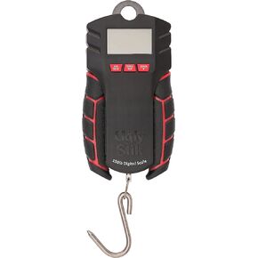
Ugly Stik Ugly Tools Digital Scale - 150 DIG Scale
KWD 25.500
-19%
Ugly Stik Ugly Tools Digital Scale - 150 DIG Scale
KWD 25.500