- Shopping, made easy.
- /
- Get the app!
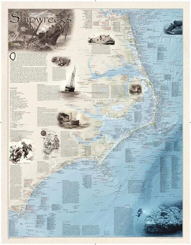
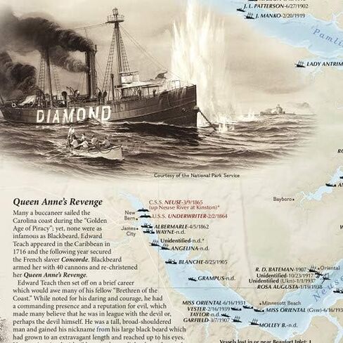
One of two regions known as the Graveyard of the Atlantic is the notorious coastline reaching from Cape Henry, Virginia to Cape Fear, North Carolina. Cape Hatteras, North Carolina, is where the cold waters of the Labrador Current collide with the warm waters of the Gulf Stream, an often violent union resulting in fog, severe weather, shifting sandbars and strong currents. Published in 2012, this map shows the location of more than 1,550 shipwrecks in the Outerbanks.
Each wreck site identified on this map is symbolized to define the class, type, and the name of the vessel, accompanied by their dates and causes of sinking. Locations of lifesaving stations, lighthouses and lightships, along with navigational beacons, are accurately marked. Bathymetric and coastal features are clearly labeled, accompanied by inset maps, captions, and drawings used to highlight unique historical events.
Wrecks featured on this map span from mid-1600s galleons to 20th-century naval ships. This map is drawn in the Transverse Mercator projection, which is a cylindrical map projection for nautical navigation because it represents lines of constant course.
This unique and intriguing map is a must-have for any nautical historian or those interested in the rich lore that has arisen from seafaring disaster. It makes a fantastic companion to Shipwrecks of Delmarva and Shipwrecks of the Northeast.
Printed on polypropylene, an ideal material for wall maps as the printing brings out rich colours, and crisp edges for readability. The material is stronger than most papers and unlikely to crease or rip. The matte finish eliminates glare, and adds texture to the map. Ideal for display.
Your map is rolled and packaged in a sturdy tube to protect it during shipment.
 National Geographic Maps: Alaska Wall Map - Compact - 21 x 16 inches - Front Lamination
KWD 7.500
National Geographic Maps: Alaska Wall Map - Compact - 21 x 16 inches - Front Lamination
KWD 7.500
 National Geographic Maps: Hawai'i Wall Map - Compact - 21 x 16 inches - Front Lamination
KWD 9.500
National Geographic Maps: Hawai'i Wall Map - Compact - 21 x 16 inches - Front Lamination
KWD 9.500
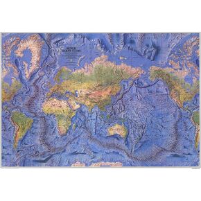 National Geographic World Ocean Floor - 42.5 x 29.5 inches - Paper Rolled
KWD 17.500
National Geographic World Ocean Floor - 42.5 x 29.5 inches - Paper Rolled
KWD 17.500
 National Geographic Maps: Japan Executive Wall Map - Antique Style - 29.25 x 25 inches - Front Lamination
KWD 15.500
National Geographic Maps: Japan Executive Wall Map - Antique Style - 29.25 x 25 inches - Front Lamination
KWD 15.500