- Shopping, made easy.
- /
- Get the app!
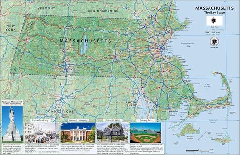
This is a large, highly detailed map of Massachusetts with all cities and towns, National Parks and National Forests, main roads and highways, major waterways, state boundaries and populated areas. This Massachusetts Map is designed to be a convenient reference for all in Massachusetts.
Size - 23.3 x 16.5 Inches.
Printed onto high quality poster paper and laminated for extra durability.
 -8%
The Big Book of Disney Songs: Flute
KWD 6
-8%
The Big Book of Disney Songs: Flute
KWD 6
 Waypoint Geographic Contemporary Series World Wall Map, Laminated World Map Poster, Educational Wall Art For Home, Classroom, or Office, Unique Gifts, 24" x 36"
KWD 11
Waypoint Geographic Contemporary Series World Wall Map, Laminated World Map Poster, Educational Wall Art For Home, Classroom, or Office, Unique Gifts, 24" x 36"
KWD 11
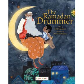 The Ramadan Drummer | Juvenile Fiction Book | Reading Age 5-9 | Grade Level K-3 | Touches on Fantasy & Magic, Holidays & Celebrations, Religion and Muslim | Reycraft Books| Coming 1/16/24!
KWD 4.500
The Ramadan Drummer | Juvenile Fiction Book | Reading Age 5-9 | Grade Level K-3 | Touches on Fantasy & Magic, Holidays & Celebrations, Religion and Muslim | Reycraft Books| Coming 1/16/24!
KWD 4.500
 Apollo UF1000E All-Purpose Transparency Film, 8-1/2-Inch x11-Inch , 50/BX, Clear
KWD 22.500
Apollo UF1000E All-Purpose Transparency Film, 8-1/2-Inch x11-Inch , 50/BX, Clear
KWD 22.500