- Shopping, made easy.
- /
- Get the app!
This highly illustrated pictorial map is designed to take children on a journey of discovery around the countries of Europe. The mapping is clear, colourful and highly informative and shows countries and capital cities. Stunning illustrations are used to depict themes such as national emblems, customs, food, birds, animals, buildings and sports to help younger readers gain an understanding of peoples around the world. The perfect introduction to maps for 4-8 year olds. Illustrated by Steve Evans. 30 x 19.5 inches. Your laminated map has a glossy finish so that you can use dry erase markers on the map to highlight features, make plans, and share unique information with others. Lamination is also extremely durable, resistant to folding or ripping. Your map is rolled and packaged in a sturdy tube to protect it during shipment.
 -8%
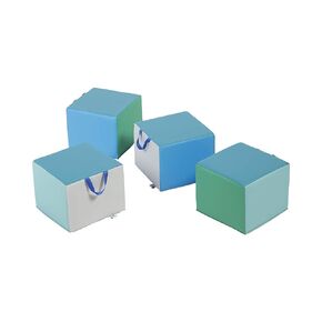
ECR4Kids SoftZone Children's Cozy Cubes, Flexible Seating, Contemporary, 4-Pack
KWD 37
-8%
ECR4Kids SoftZone Children's Cozy Cubes, Flexible Seating, Contemporary, 4-Pack
KWD 37
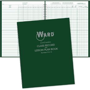 Combination 9-10 Week Class Record + 6 Period Lesson Plan Book
KWD 7
Combination 9-10 Week Class Record + 6 Period Lesson Plan Book
KWD 7
 Proportional Scale Divider Drawing Tool, 10 Inches Artist Drawing Tool Multifunction Adjustable Drafting Tool Scale Divider for Art Drawing(Black)
KWD 4.500
Proportional Scale Divider Drawing Tool, 10 Inches Artist Drawing Tool Multifunction Adjustable Drafting Tool Scale Divider for Art Drawing(Black)
KWD 4.500
 Collins Children's World Wall Map - 36.25 x 24.25 inches - Paper
KWD 10.500
Collins Children's World Wall Map - 36.25 x 24.25 inches - Paper
KWD 10.500


