- Shopping, made easy.
- /
- Get the app!

Rand McNally's folded map for Raleigh is a must-have for anyone traveling in and around this part of North Carolina, offering unbeatable accuracy and reliability at a great price. Our trusted cartography shows all Interstate, U.S., state, and county highways, along with clearly indicated parks, points of interest, airports, county boundaries, and streets. The easy-to-use legend and detailed index make for quick and easy location of destinations. You'll see why Rand McNally folded maps have been the trusted standard for years. - Regularly updated. - Full-color maps. - Clearly labeled Interstate, U.S., state, and county highways. - Indications of parks, points of interest, airports, county boundaries, downtown & vicinity maps. - Major attractions & Golf Courses. Coverage Area Communities Included: Apex*, Cary*, Durham*, Garner*, Holly Springs, Knightdale*, Morrisville, Wake Forest*, Durham County*, Wake County* *Partial Coverage. Product Details: Measures 9.5' x 4' and folds out to 40' x 28'.
 Interactive Books Russian Language Learning - Russian Alphabet with Sound Module
KWD 14.500
Interactive Books Russian Language Learning - Russian Alphabet with Sound Module
KWD 14.500
 -45%
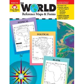
Evan-Moor Educational Publishers The World: Reference Maps & Forms Book (World & U.S. Maps)
KWD 6
-45%
Evan-Moor Educational Publishers The World: Reference Maps & Forms Book (World & U.S. Maps)
KWD 6
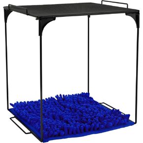 AUECOOME Locker Organizer Shelf and Locker Carpet 、Pink Locker Shelf、Locker Accessories、Decorating Kit Suitable for School, Office、Back to School Essentials
KWD 7
AUECOOME Locker Organizer Shelf and Locker Carpet 、Pink Locker Shelf、Locker Accessories、Decorating Kit Suitable for School, Office、Back to School Essentials
KWD 7
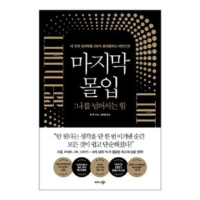 Korean Books, Successology/Limitless: Upgrade Your Brain, Learn Anything Faster, and Unlock Your Exceptional Life 마지막 몰입 - 짐 퀵/Shipping from Korea
KWD 16
Korean Books, Successology/Limitless: Upgrade Your Brain, Learn Anything Faster, and Unlock Your Exceptional Life 마지막 몰입 - 짐 퀵/Shipping from Korea
KWD 16
