- Shopping, made easy.
- /
- Get the app!
1890 Map New Mexico Official of New Mexico Shows settlements, townships, land grants, Indian reservations, and railroads.
 Funny Office Desk Decor Sign Humor Office Cubicle Box Sign Sarcastic Office Decorations for Work Women Men, Cute Cubicle Desk Accessories Supplies
KWD 5
 4-Section Coat Locker with Bench & Cubby Storage Organizer Cubes, Wooden Backpack Storage Organizer with Coat Hooks and Cubbies for Kids, Daycare, Classroom
KWD 90.500
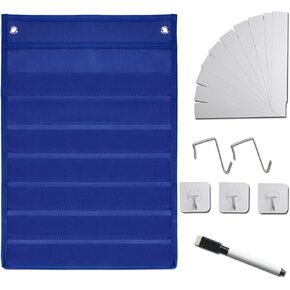
 Standard Pocket Charts for Classroom Teacher Teaching Supplies, Sentence Strip Pocket Chart with 10 Dry-Eraser Cards for School Activities Teacher Lessons Class Demonstrations or Home Use
KWD 5.500
 1898 Map Alaska|Canada|Yukon Territory|Klondike (River) Bacon's New Large-Print of Alaska & The|Vintage Fine Art Reproduction|Ready to Frame
KWD 8.500