- Shopping, made easy.
- /
- Get the app!

Rand McNally's folded map for Atlanta is a must-have for anyone traveling in and around the Atlanta area, offering unbeatable accuracy and reliability at a great price. Our trusted cartography shows all Interstate, U.S., state, and county highways, along with clearly indicated parks, points of interest, airports, county boundaries, and streets. The easy-to-use legend and detailed index make for quick and easy location of destinations. You'll see why Rand McNally folded maps have been the trusted standard for years. Folded map features: - Regularly updated. - Full-color maps. - Clearly labeled Interstate, U.S., state, and county highways. - Indications of parks, points of interest, airports, county boundaries, downtown & vicinity maps. - Easy-to-use legend. - Convenient folded size. - Major Street Index. - Points of Interest. - Enlargements of Downtown Atlanta. - Piedmont Park Area. - Buckhead. - Atlanta International Airport. - Atlanta Perimeter Center. - Atlanta Northwest Galleria. Coverage Area Communities Included: Bartow County, Cherokee County, Clayton County, Cobb County, Douglas County, DeKalb County, Fayette County, Floyd County, Fulton County, Gordon County, Gwinett County, Hall County, Henry County. Product Details: Measures 9.5' x 4' and folds out to 40' x 28'.
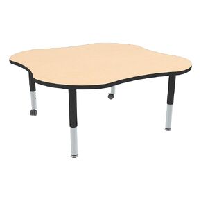 Sprogs Adjustable Height Mobile Classroom Activity Table for Preschools, Clover Preschool Activity Table with Casters, 48"L x 48"W x 23"H, Gray/Blue
KWD 115.500
Sprogs Adjustable Height Mobile Classroom Activity Table for Preschools, Clover Preschool Activity Table with Casters, 48"L x 48"W x 23"H, Gray/Blue
KWD 115.500
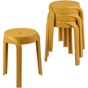 MITLOXX 17.7 inch Height Modern Plastic Stool (Set of 4), Round Stackable Chair, Unique Whirl Design, Flexible Seating for Home, Office, Classroom, Shower etc. Waterproof for Indoor/Outdoor (Grey)
KWD 62
MITLOXX 17.7 inch Height Modern Plastic Stool (Set of 4), Round Stackable Chair, Unique Whirl Design, Flexible Seating for Home, Office, Classroom, Shower etc. Waterproof for Indoor/Outdoor (Grey)
KWD 62
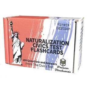 USCIS US Citizenship Test Study Flashcards Corrected Edition | All 100 Questions and Answers for The United States Naturalization Civics Exam | 2021 & 2022 | Made in USA
KWD 8.500
USCIS US Citizenship Test Study Flashcards Corrected Edition | All 100 Questions and Answers for The United States Naturalization Civics Exam | 2021 & 2022 | Made in USA
KWD 8.500
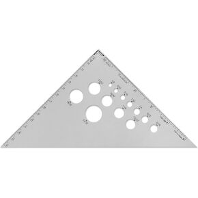 Alumicolor Aluminum 6 Inch Calibrated Drafting Triangle, 45/90 Degree
KWD 5.500
Alumicolor Aluminum 6 Inch Calibrated Drafting Triangle, 45/90 Degree
KWD 5.500
