- Shopping, made easy.
- /
- Get the app!

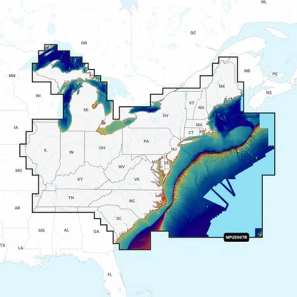
Get the world's No. 1 choice in marine mapping — with the best, most up-to-date Navionics Platinum+ premium marine cartography on your compatible chartplotter. For offshore or inland waters, this all-in-one solution offers detail-rich integrated mapping of coastal waters, lakes, rivers and more. Get 1' (0.5 meter) HD contours, premier-grade chart features, including high-resolution relief shading, satellite imagery with SonarChart Shading overlay and 3D views, plus dock-to-dock route guidance technology, live mapping and Plotter Sync to provide wireless access to daily updates. The Navionics Chart Installer software also ensures access to the freshest chart data every time out. Navionics route guidance solutions give you a suggested path to follow through channels, inlets, marina entrances and more, while multiple shading options aid in shallow water navigation and make it easy to highlight a target depth range for the best fishing spots.
 Lowrance 000-10802-001 Skimmer Transom Mount Tranducer for LSS-2 StructureScan HD Fishfinder
KWD 75.500
Lowrance 000-10802-001 Skimmer Transom Mount Tranducer for LSS-2 StructureScan HD Fishfinder
KWD 75.500
 -20%
Navionics 010-C1370-30+ Naus007r U.s. East
KWD 43.500
-20%
Navionics 010-C1370-30+ Naus007r U.s. East
KWD 43.500
 Navionics Garmin 010-C1367-30 Canada & Alaska microSD/SD Card NAUS004R
KWD 57
Navionics Garmin 010-C1367-30 Canada & Alaska microSD/SD Card NAUS004R
KWD 57
 -13%
Navionics Garmin 010-C1369-30 microSD/SD Card NAUS006R - U.S. South, Black
KWD 52
-13%
Navionics Garmin 010-C1369-30 microSD/SD Card NAUS006R - U.S. South, Black
KWD 52