Cartographic detail Large Africa Wall Map: We ensure our maps are up to date and provide accurate details including current political boundaries for 2024. The political map of the world features coloured countries, clear towns and c the best mapping detail you will find for this Africa map poster. Featuring countries, cities, hill shading and country outlines on mapping.
Extra large Africa wall map: this poster measures 36 x 48 inches - politically coloured wall map of Africa features countries marked in a different colour, with international boundaries shown.
Africa map traveller gift: this Africa map makes perfect gift for the travel enthusiast in your life. Inspire learning for the little ones at home or in the classroom and get them excited about geography! Traveling can create a special connection and our maps are here to support that!
CREASELESS DELIVERY: Your Large Africa Wall Map Political (Laminated) is packaged by our specialist map team in Minnesota, for delivery, so it arrives safely and ready to display.
MAPS INTERNATIONAL: Our philosophy of 'cartographic excellence' combines detail, design and high quality finishes in a range of stunning wall maps.
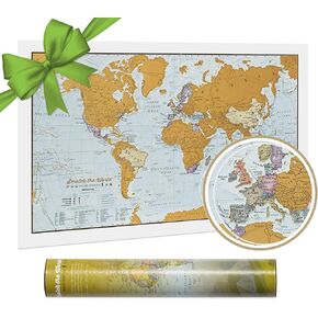 Maps International Scratch Off Map of the United States - USA Wall Map - Scratch Off - Detailed cartography - US States - National Parks
KWD 7
Maps International Scratch Off Map of the United States - USA Wall Map - Scratch Off - Detailed cartography - US States - National Parks
KWD 7
 Maps International Giant World Map - Mega-Map Of The World - 46 x 80 - Full Lamination - 2024 Updated
KWD 16.500
Maps International Giant World Map - Mega-Map Of The World - 46 x 80 - Full Lamination - 2024 Updated
KWD 16.500
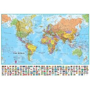 Maps International - Large World Map – Wall Map Poster With Flags – Laminated - 23 x 33
KWD 10.500
Maps International - Large World Map – Wall Map Poster With Flags – Laminated - 23 x 33
KWD 10.500
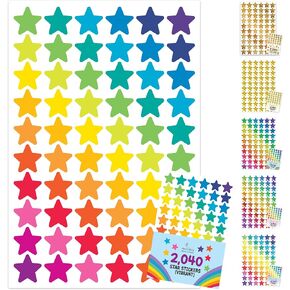 2,040 Star Stickers for Kids Reward - 10 Small Stars Stickers for Kids, Colored Star Stickers, Small Star Stickers for Kids Reward Chart, Rainbow Star Stickers, Stickers Star Sticker, Mini Stickers
KWD 2.500
2,040 Star Stickers for Kids Reward - 10 Small Stars Stickers for Kids, Colored Star Stickers, Small Star Stickers for Kids Reward Chart, Rainbow Star Stickers, Stickers Star Sticker, Mini Stickers
KWD 2.500


