- Shopping, made easy.
- /
- Get the app!
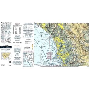
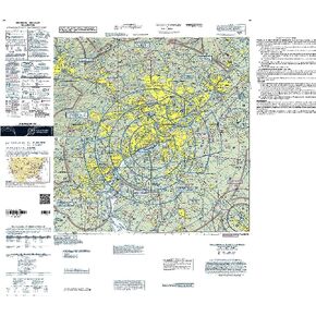
For Central California pilots, the FAA's San Francisco Sectional Aeronautical Chart is a low-cost, high-caliber, info-packed resource for all the relevant, safety-enhancing data they need to maintain situational awareness from takeoff to touchdown. As is characteristic of the FAA's entire lineup of sectional charts, the San Francisco Sectional contains such need-to-know aeronautical data as airport info (runway lengths, lighting, elevation, services available, surface type, etc.); airspace dimensions; VHF and LF/MF navigational facilities (frequency, ID, and channel); landmarks; cities & towns; elevation/topographic info; ATC entities and associated contact/radio frequencies; bodies of water; obstructions; and much, much more.The San Francisco Sectional covers much of Central California and a portion of Western Nevada, as well as a sizable chunk of the Pacific Coastline. Uses the standard 1:500,000 (6.86 nm per inch; 2.70 nm per cm) scale characteristic of sectional charts. Updated every six months. An affordable, data-rich publication that should be an integral item in every West Coast flyer's flight bag.