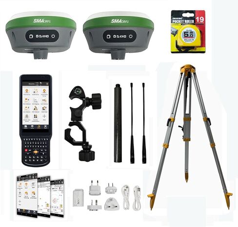
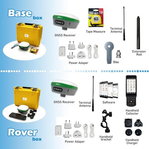
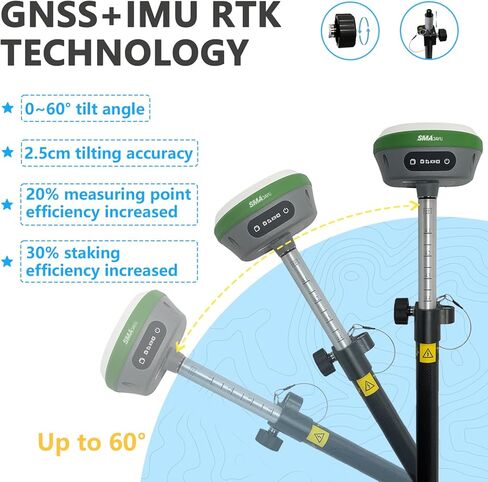
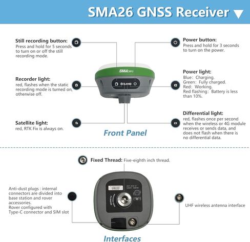
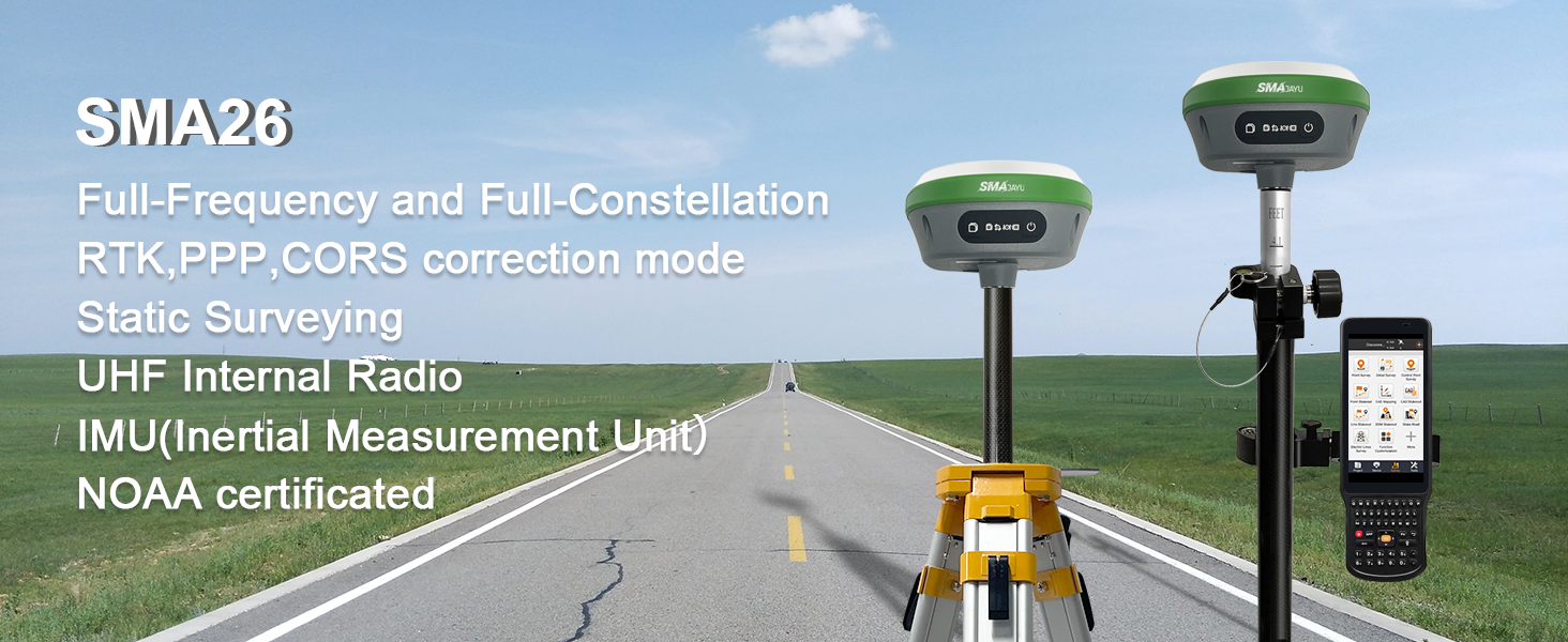
Capability: ① GNSS RTK Rover+Base+ Collector(Software permanent valid)+Tripod; ② 0.3-0.8cm RTK accuracy and Full-Frequency and Full-Constellation; ③ 5-10km UHF distance between rover and base; ④ 30°-60° IMU tilt measurement with centimeters accuracy; ⑤ 10000mah battery for 2 working days battery life each charge
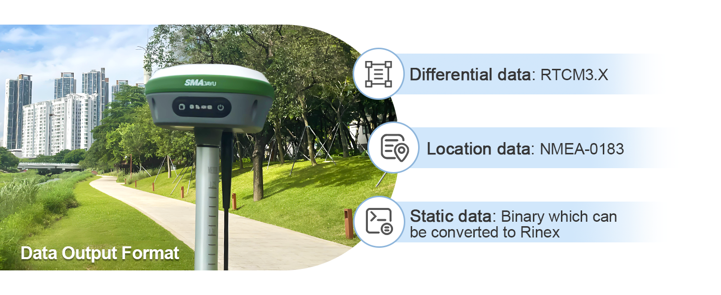
Advantages: ① NOAA: SMA26 antenna is NOAA certificated which adapt for standard post-processed software; ② Data output format: Differential data: RTCM3.X, Location data: NMEA-0183, Static data: Binary which can be converted to Rinex; ③ PPP method: PPP method by Galileo HAS correction; ④ PPK is Upgradeable in near future, which can adopt for more challenge environment; ⑤ Connection by: BT/WiFi/USB-Type-C/TNC Connector/Serial Port(DB9 cable optional)
Multiple constellation adaptable to any country and suitable for use in various complex and challenging environments: - GPS L1C/A/L2P(Y)/L2C /L5 - GLONASS G1/G2/G3- BDS B1I/B2I/B3I/B1C/B2a/B2b* - GALILEO E1/E5a/E5b /E6* - QZSS L1, L2, L5
RTK Connection: Rover+base:Connect Collector with GNSS receiver by WIFI on WEBUI or BT to set rover and base at the same protocol and frequency till RTK fixed. Or Rover+CORS: login CORS account on software till RTK fixed
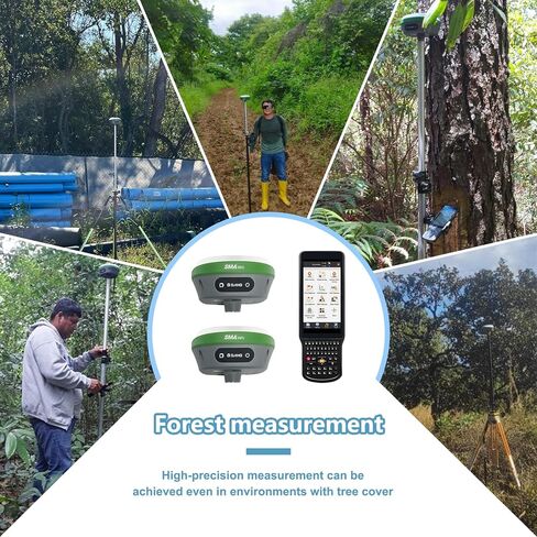
Application: The SMA26 RTK GNSS receiver provides the accuracy needed for a wide range of surveying and engineering applications, including topographic surveying, geographic surveying, engineering surveying, agriculture field measurement, mine surveying, construction surveying and hydrographic surveying
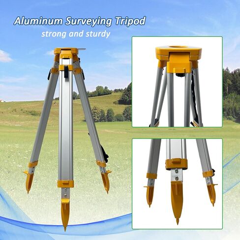
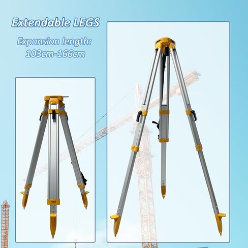
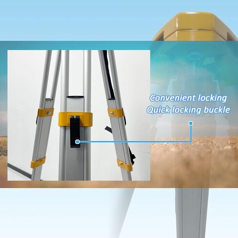
 Surveying Tripod Aluminum Survey Tripod Stand Stretchable Tripod
KWD 43
Surveying Tripod Aluminum Survey Tripod Stand Stretchable Tripod
KWD 43
 Synergy Digital Camera Tripod, Compatible with Kodak PIXPRO AZ255 Digital Camera, Approx. 9 Inch Height
KWD 4.500
Synergy Digital Camera Tripod, Compatible with Kodak PIXPRO AZ255 Digital Camera, Approx. 9 Inch Height
KWD 4.500
 -11%
Action 2 Protective Frame with Hot Shoe Base Anti-Drop Dust Protection case Cover Mount+ Action 2 Screen Protector Kits for DJI osmo Action 2 Camera Accessories
KWD 4
-11%
Action 2 Protective Frame with Hot Shoe Base Anti-Drop Dust Protection case Cover Mount+ Action 2 Screen Protector Kits for DJI osmo Action 2 Camera Accessories
KWD 4
 5/8"-11 Male to 1/4"-20 Female Threaded Screw Adapter for Tripod Laser Level Adapter (Black)
KWD 4
5/8"-11 Male to 1/4"-20 Female Threaded Screw Adapter for Tripod Laser Level Adapter (Black)
KWD 4