- Shopping, made easy.
- /
- Get the app!
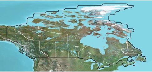
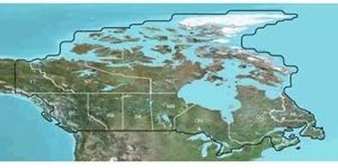
TOPO Canada - microSD/SDOutdoor enthusiasts: we've mapped every hill and valley for your next great adventure. This mapping product covers the finer details of the outdoors, including terrain contours, topo elevations, summits, routable roads and trails, rivers, lakes and geographical :Provides detailed topographic maps, based on digital 1:250,000 and 1:50,000 scale NTS dataContains hydrographic features, including coastlines, lake/river shorelines, wetlands and perennial and seasonal streamsIncludes searchable points of interests, such as parks, campgrounds, scenic lookouts and picnic sitesOffers terrain contour and elevation information, along with summits, peaks and geographic pointsContains routable roads, trails and highways in metropolitan and rural areas so getting to your destination is easyDisplays national, state, local parks, forests and wilderness areasIncludes BaseCamp software (DVD Only) for managing data on your GPS and computer, playing back routes and tracks, geotagging photos and moreCoverage:Features digital topographic maps for all of Canada.
 -6%
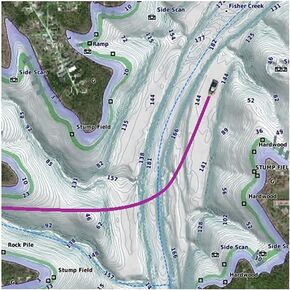
Garmin LakeVü g3 Ultra U.S. - West
KWD 62.500
-6%
Garmin LakeVü g3 Ultra U.S. - West
KWD 62.500
 -5%
Garmin 010-C1204-00 LAKEVU g3 Ultra East
KWD 60.500
-5%
Garmin 010-C1204-00 LAKEVU g3 Ultra East
KWD 60.500
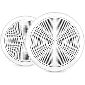 Garmin Fusion® FM Series Marine Speakers, 7.7" 200-Watt Flush Mount Round White, A Brand
KWD 87
Garmin Fusion® FM Series Marine Speakers, 7.7" 200-Watt Flush Mount Round White, A Brand
KWD 87
 Garmin ECHOMAP Ultra 2 12-inch Chartplotter with LiveScope Plus Bundle, GPS, Chirp Sonar, Navionics+ Charts
KWD 1,123.500
Garmin ECHOMAP Ultra 2 12-inch Chartplotter with LiveScope Plus Bundle, GPS, Chirp Sonar, Navionics+ Charts
KWD 1,123.500