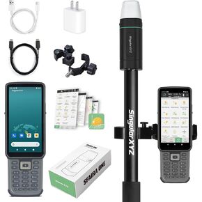
RTK GNSS Survey Equipment 60° Tilt Built-in IMU,Equipped with Rover Handheld GPS for Surveying and Survey Software Ideal for Land Surveying,GIS,Mine Surveying,Topographic Survey
All electronics ship with US style plugs.You may need a voltage converter or a plug adapter.
Special Features
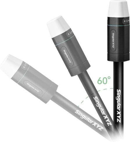
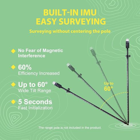
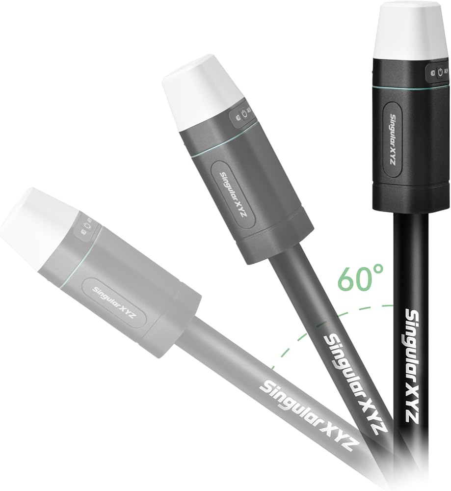
【Why Choose Sfaira ONE Plus?】Our gnss rtk is Up to 60° tilt surveying, pocket-size portability, and a 16-hour battery. Sfaira ONE Plus tracks GPS, BDS, GLONASS, Galileo, and QZSS for a professional and efficient surveying experience.
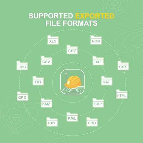
【Wide Applications】The accurate coordinates, elevation, distance and azimuth data measured by rtk gps Sfaira ONE Plus can be used in land surveying, GIS, mine surveying, topographic survey, cadastral survey, road stakeout, robotics, etc.
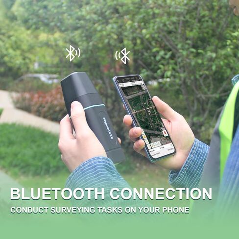
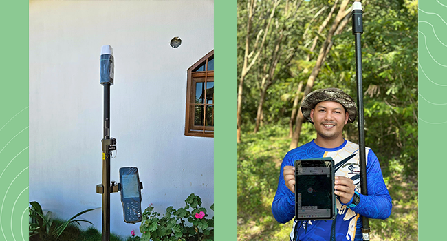
【How to use?】 ① Connect the Sfaira ONE Plus with your phone via Bluetooth. ② Login to your CORS account (RTK corrections service) in the software or connect to your RTK base station of internal GSM mode and get fixed RTK solution. ③ Initialize the tilt IMU function - shake the pole for 5 seconds. ④ Start working: the software supports Point Survey, Detail Survey, CAD Mapping, CAD stakeout, Road Stakeout, Surface Stakeout, Layer Editting and wide calculation functions.
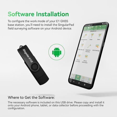
【Software Free Upgrade】The android-based field surveying software can be installed on your smart phones, data collectors and tablets. The latest upgraded software version is always available for every user.
【Easy to get started】Tutorial videos, detailed manual and online one-to-one technical support can definitely help every user to get started with gnss surveying equipment Sfaira ONE Plus easily without concerns.
【Support】Please refer to the manual included in the package, email us for technical support, or visit the SingularXYZ website to get in touch. We also offer video conference guidance of our gps rtk to assist you.

 E1 GNSS GPS RTK Base Station Land Surveying Equipment Total Station GNSS Receiver High Accuracy Static Surveying, Coodinates Collection, Point Surveying
KWD 350.500
E1 GNSS GPS RTK Base Station Land Surveying Equipment Total Station GNSS Receiver High Accuracy Static Surveying, Coodinates Collection, Point Surveying
KWD 350.500
 -6%
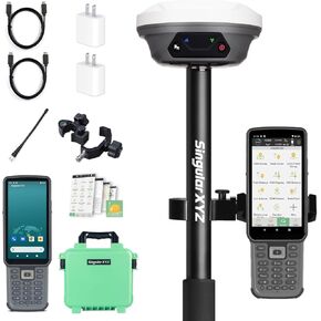
RTK GNSS Survey Equipment with Network RTK Rover, Handheld Controller and Survey Software, Featuring a 60° Tilt and Built-in IMU, for Construction and Geodetic or Land Survey Layout Planning
KWD 540
-6%
RTK GNSS Survey Equipment with Network RTK Rover, Handheld Controller and Survey Software, Featuring a 60° Tilt and Built-in IMU, for Construction and Geodetic or Land Survey Layout Planning
KWD 540
 -6%
E1 GNSS IMU RTK GPS Surveying Equipment Rover Receiver Rtk Gnss Handheld Collector and Survey Software, 1408 Channels, 1cm Accuracy, 5km Distance
KWD 569
-6%
E1 GNSS IMU RTK GPS Surveying Equipment Rover Receiver Rtk Gnss Handheld Collector and Survey Software, 1408 Channels, 1cm Accuracy, 5km Distance
KWD 569
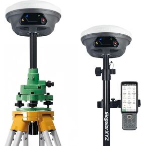 E1 RTK GNSS Survey Equipment 20 Hours Endurance RTK GNSS GPS with IMU Rover & Base Handheld Collector with Survey Software RTK Surveying Equipment,1408 Channels, 5km UHF Range,60° Tilt Survey
KWD 924
E1 RTK GNSS Survey Equipment 20 Hours Endurance RTK GNSS GPS with IMU Rover & Base Handheld Collector with Survey Software RTK Surveying Equipment,1408 Channels, 5km UHF Range,60° Tilt Survey
KWD 924