All electronics ship with US style plugs.You may need a voltage converter or a plug adapter.
Special Features
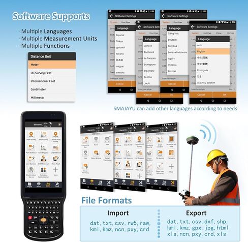
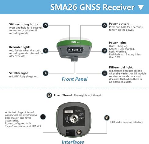
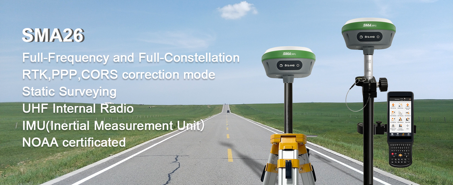
Advantages: ①NOAA: SMA26 antenna is NOAA certificated which adapt for standard post-processed system; ②Data output format: Differential data: RTCM3.X, Location data: NMEA-0183, Static data: Binary which can be converted to Rinex; ③PPK is Upgradeable in near future, which can make static during base mode; ④CORS network connection supported by login a CORS account on collector
⑥Connection by: BT/WiFi/USB-Type-C/TNC Connector/Serial Port(DB9 cable optional); ⑦Multiple constellation adaptable to any country and suitable for use in various complex and challenging environments: - GPS L1C/A/L2P(Y)/L2C /L5 - GLONASS G1/G2/G3- BDS B1I/B2I/B3I/B1C/B2a/B2b* - GALILEO E1/E5a/E5b /E6* - QZSS L1, L2, L5
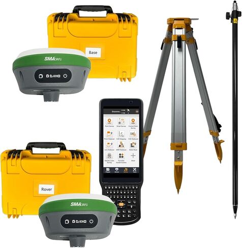
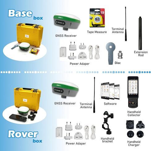
Capability: RTK GPS Land surveying equipment Rover+Base+ Collector(Software permanent valid)+Pole+Tribrach. ①0.5-0.8cm RTK accuracy and Full-Frequency and Full-Constellation; ②5-10km UHF distance between rover and base; ③30°-60° IMU tilt measurement with centimeters accuracy; ④2 working days battery life each charge; ⑤10cm accuracy by PPP method, no need base station; ⑥2.5cm accuracy by CORS network station
RTK Connection: Rover+Base:Connect Collector with GNSS receiver by WIFI on WEBUI or BT to set rover and base at the same protocol and frequency till RTK fixed. Or Rover+CORS: login CORS account on software till RTK fixed
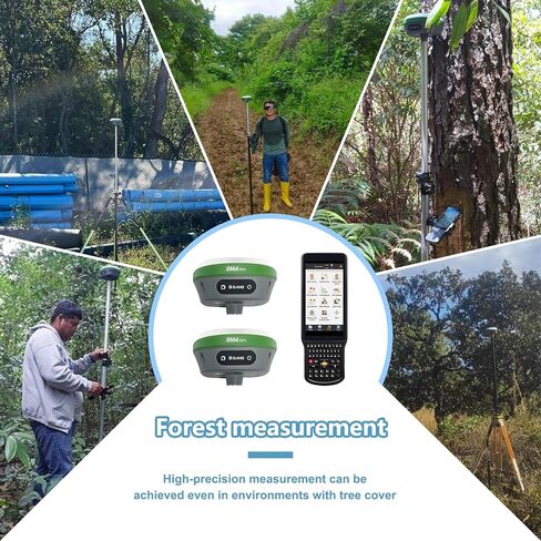
Application: The SMA26 RTK GNSS receiver provides the accuracy needed for a wide range of surveying and engineering applications, including topographic surveying, geographic surveying, engineering surveying, agriculture field measurement, mine surveying, construction surveying

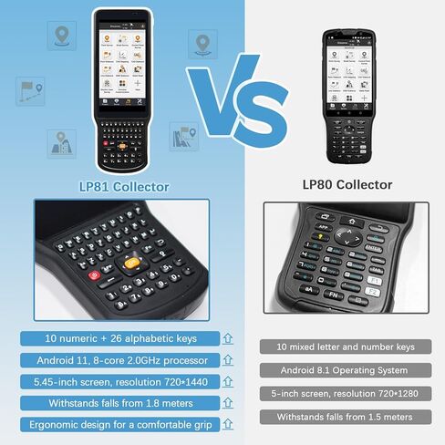
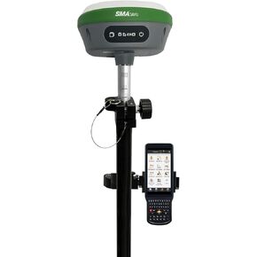 SMA26 RTK Rover with Collector Installed Permanent Surveying Software, RTK Receiver NOAA certificated,Static Survey,RTK Survey by CORS and PPP Survey for Topographic,Land Surveying (Exclude Pole)
KWD 536.500
SMA26 RTK Rover with Collector Installed Permanent Surveying Software, RTK Receiver NOAA certificated,Static Survey,RTK Survey by CORS and PPP Survey for Topographic,Land Surveying (Exclude Pole)
KWD 536.500
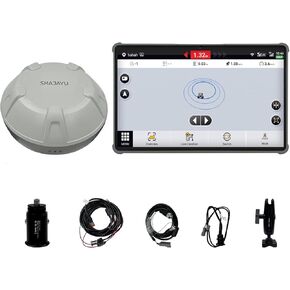 SMA10 Tractor GPS Guidance System for Agriculture, Precision Farming Navigation System with PPP and SBAS, 10cm Accuracy by PPP, High Accuracy Anti-Interference GNSS Antenna
KWD 620
SMA10 Tractor GPS Guidance System for Agriculture, Precision Farming Navigation System with PPP and SBAS, 10cm Accuracy by PPP, High Accuracy Anti-Interference GNSS Antenna
KWD 620
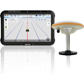 JY100 V1 Tractor GPS Guidance System 30cm Accuracy High Precision Farming GPS Strong Anti-Interference GNSS Antenna,Works Without Internet Suitable for Various Tractors
KWD 422.500
JY100 V1 Tractor GPS Guidance System 30cm Accuracy High Precision Farming GPS Strong Anti-Interference GNSS Antenna,Works Without Internet Suitable for Various Tractors
KWD 422.500
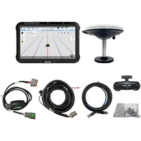 JY100 V2 GNSS Guidance System for Tractor 30cm High Accuracy GNSS Antenna Strong Anti-Interference Support A-B line Navigation Farm Management,Imperial Measurement
KWD 422.500
JY100 V2 GNSS Guidance System for Tractor 30cm High Accuracy GNSS Antenna Strong Anti-Interference Support A-B line Navigation Farm Management,Imperial Measurement
KWD 422.500