All electronics ship with US style plugs.You may need a voltage converter or a plug adapter.
Special Features
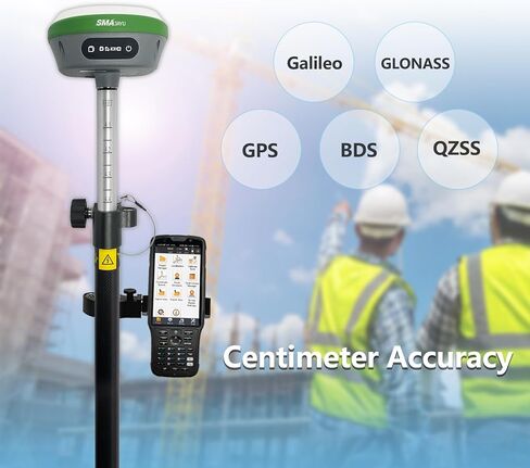
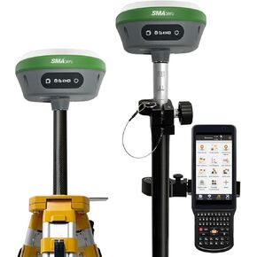
【NOAA Certified】 SMA26RTK is officially certified by NOAA and fully compatible with standard post-processing systems, ensuring reliable performance for precise geospatial data collection
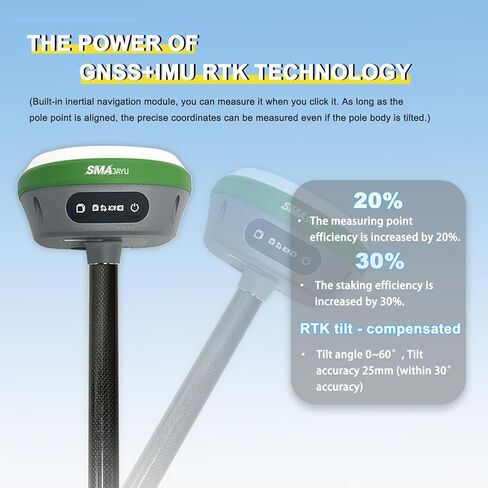
【0.5cm Exceptional RTK Accuracy】 Delivers 3mm–8mm accuracy when surveying with rover + base, based on real-world buyer feedback and extensive field testing
【Wide Protocol Compatibility】 Capable of receiving and broadcasting signals compatible with Transparent, TT450S,Trimtalk, TRMMARK3, SOUTH, SATEL and other standard radio protocols ensuring compatibility with a wide range of base stations and GNSS ecosystems
【Expert Support from Surveying Engineers】 Buyers can reach out to the SMAJAYU technical team via email for expert assistance, ensuring smooth setup and operation. A detailed PDF e-manual and instructional videos are also provided for self-guided support. Surveying software installed in Handheld and Permanently Valid


 SMAJAYU R26 V2 GNSS IMU RTK GPS Surveying Equipment Rover Base Handheld,IMU Built-in, 1408 Channels, 1cm Accuracy, 5km Distance
KWD 994.500
SMAJAYU R26 V2 GNSS IMU RTK GPS Surveying Equipment Rover Base Handheld,IMU Built-in, 1408 Channels, 1cm Accuracy, 5km Distance
KWD 994.500
 SMA26 RTK Rover with Collector Installed Permanent Surveying Software, RTK Receiver NOAA certificated,Static Survey,RTK Survey by CORS and PPP Survey for Topographic,Land Surveying (Exclude Pole)
KWD 536.500
SMA26 RTK Rover with Collector Installed Permanent Surveying Software, RTK Receiver NOAA certificated,Static Survey,RTK Survey by CORS and PPP Survey for Topographic,Land Surveying (Exclude Pole)
KWD 536.500
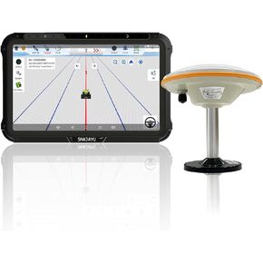 JY100 V1 Tractor GPS Guidance System 30cm Accuracy High Precision Farming GPS Strong Anti-Interference GNSS Antenna,Works Without Internet Suitable for Various Tractors
KWD 422.500
JY100 V1 Tractor GPS Guidance System 30cm Accuracy High Precision Farming GPS Strong Anti-Interference GNSS Antenna,Works Without Internet Suitable for Various Tractors
KWD 422.500
 -20%
SMA26 GNSS IMU RTK GPS Surveying Equipment Rover Base Handheld Collector and Survey Software, NOAA certificated, 1408 Channels, 1cm Accuracy(Exclude Tripod&Pole)
KWD 741
-20%
SMA26 GNSS IMU RTK GPS Surveying Equipment Rover Base Handheld Collector and Survey Software, NOAA certificated, 1408 Channels, 1cm Accuracy(Exclude Tripod&Pole)
KWD 741