All electronics ship with US style plugs.You may need a voltage converter or a plug adapter.
Special Features
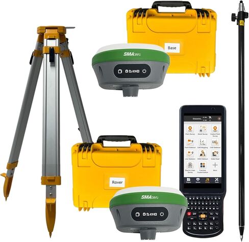
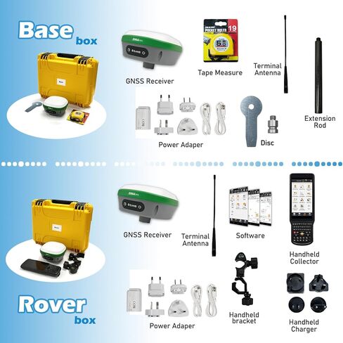
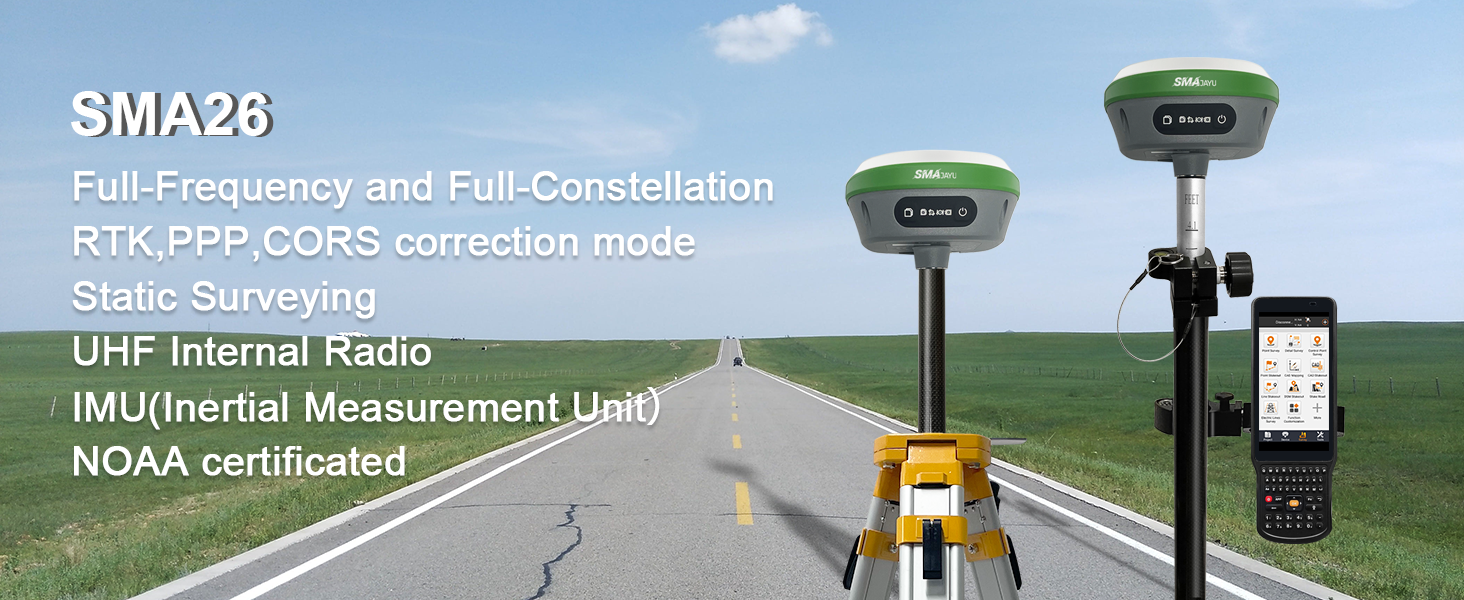
Capability: ① GNSS RTK Rover+Base+ Collector(Software permanent valid)+Pole+Tribrach; ② 0.3-0.8cm RTK accuracy and Full Frequency and Full-Constellation; ③ 5-10km UHF distance between rover and base; ④ 30°-60° IMU tilt measurement with centimeters accuracy; ⑤ 2 working days battery life each charge
Advantages: ①NOAA: SMA26 antenna is NOAA certificated which adapt for US National spatial reference system and other standard post-processed software; ②Data output format: Differential data: RTCM3.X, Location data: NMEA-0183, Static data: Binary which can be converted to Rinex; ③ PPP method: PPP method by Galileo HAS correction; ④ Connection by: BT/WiFi/USB-Type-C/TNC Connector/Serial Port(DB9 cable optional)
Multiple constellation adaptable to any country and suitable for use in various complex and challenging environments: - GPS L1C/A/L2P(Y)/L2C /L5 - GLONASS G1/G2/G3- BDS B1I/B2I/B3I/B1C/B2a/B2b* - GALILEO E1/E5a/E5b /E6* - QZSS L1, L2, L5
RTK Connection: Rover+base:Connect Collector with GNSS receiver by WIFI on WEBUI or BT to set rover and base at the same protocol and frequency till RTK fixed. Or Rover+CORS: login CORS account on software till RTK fixed
Application: The SMA26 RTK GNSS receiver provides the accuracy needed for a wide range of surveying and engineering applications, including topographic surveying, geographic surveying, engineering surveying, agriculture field measurement, mine surveying, construction surveying and hydrographic surveying

 JY305 Tractor Auto Steer System 2.5cm Accuracy with RTK Base and PPP Mode 10cm+ Accuracy, Planting,Spraying,harvesting Alone AB line in Straight/Curve or A+ line, Pivot,U-Turn..
KWD 1,523.500
JY305 Tractor Auto Steer System 2.5cm Accuracy with RTK Base and PPP Mode 10cm+ Accuracy, Planting,Spraying,harvesting Alone AB line in Straight/Curve or A+ line, Pivot,U-Turn..
KWD 1,523.500
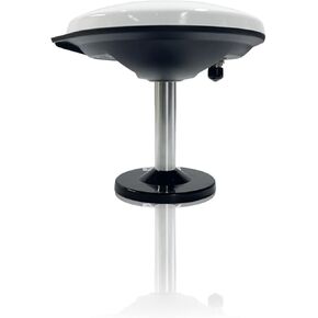 601A GNSS Antenna NOAA certificated for JY100 Tractor GPS Guidance System Strong Anti-Interference GNSS GPS GLONASS Galileo Multiple Bands High Precision
KWD 60
601A GNSS Antenna NOAA certificated for JY100 Tractor GPS Guidance System Strong Anti-Interference GNSS GPS GLONASS Galileo Multiple Bands High Precision
KWD 60
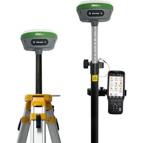 R26 V1 NOAA GNSS IMU RTK GPS Land Surveying Equipment Rover Base Collector and Survey Software Included, NOAA certificated, 1cm Accuracy(Exclude Tripod&Pole)
KWD 824
R26 V1 NOAA GNSS IMU RTK GPS Land Surveying Equipment Rover Base Collector and Survey Software Included, NOAA certificated, 1cm Accuracy(Exclude Tripod&Pole)
KWD 824
 SMAJAYU R26 V2 GNSS IMU RTK GPS Surveying Equipment Rover Base Handheld,IMU Built-in, 1408 Channels, 1cm Accuracy, 5km Distance
KWD 994.500
SMAJAYU R26 V2 GNSS IMU RTK GPS Surveying Equipment Rover Base Handheld,IMU Built-in, 1408 Channels, 1cm Accuracy, 5km Distance
KWD 994.500