- Shopping, made easy.
- /
- Get the app!
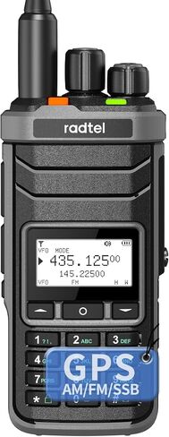
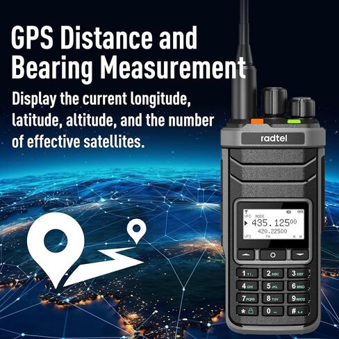
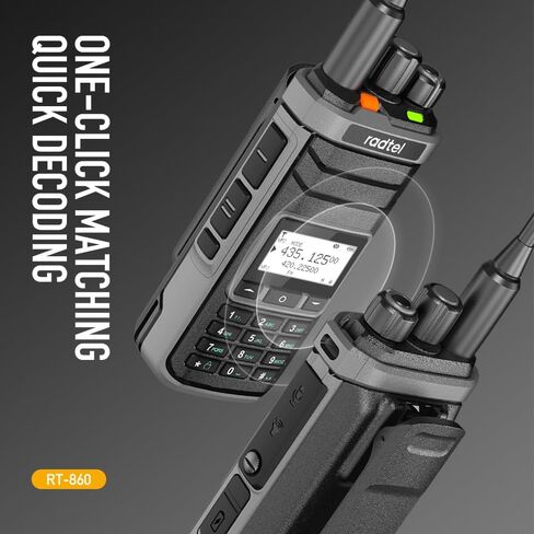
GPS Distance and Bearing Measurement Define a custom key function as "GPS" and trigger this key operation on the standby interface to enter the GPS display interface. This interface provides real-time information on longitude, latitude, altitude, and the number of available satellites. For optimal performance, use GPS in an open outdoor environment. Obstructions such as buildings, trees, or other obstacles may cause GPS drift, affecting positioning accuracy.
 Radtel RT-900 GMRS Radio 8W Long Range Handheld Walkie Talkie - 256 Channels, Air Band,NOAA Weather Receiver & Scanner, Aviation, Two-Way Radio Phone App Programmed via Bluetooth
KWD 15
Radtel RT-900 GMRS Radio 8W Long Range Handheld Walkie Talkie - 256 Channels, Air Band,NOAA Weather Receiver & Scanner, Aviation, Two-Way Radio Phone App Programmed via Bluetooth
KWD 15
 -18%
Radtel RT-470X Tri-Band Radio Walkie Talkies 256CH Aviation Air Band Two Way Radio Scanner Marine Long Range Handheld Transceiver USB-C, Wireless Copy Frequency (Two Pack)
KWD 20.500
-18%
Radtel RT-470X Tri-Band Radio Walkie Talkies 256CH Aviation Air Band Two Way Radio Scanner Marine Long Range Handheld Transceiver USB-C, Wireless Copy Frequency (Two Pack)
KWD 20.500
 radtel USB Programming Cable for RT-490 RT-470 RT-470X, UV-K5 RT-590, Compatible RT12 RT-890 RT-830 8800 Plus UV9D AR-869 jc-8629 Walkie Talkie
KWD 4
radtel USB Programming Cable for RT-490 RT-470 RT-470X, UV-K5 RT-590, Compatible RT12 RT-890 RT-830 8800 Plus UV9D AR-869 jc-8629 Walkie Talkie
KWD 4
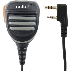 radtel Platinum Series Rainproof Heavy Duty Shoulder Speaker Mic Compatible RT-470X RT-470 RT-490 RT-890 RT-830 RT-495 A36Plus Kenwood radios,Microphone… (Advanced Mic)
KWD 4.500
radtel Platinum Series Rainproof Heavy Duty Shoulder Speaker Mic Compatible RT-470X RT-470 RT-490 RT-890 RT-830 RT-495 A36Plus Kenwood radios,Microphone… (Advanced Mic)
KWD 4.500