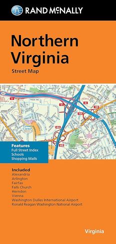
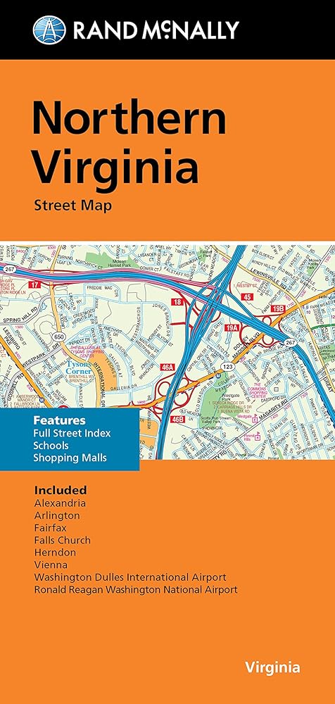
Clearly labeled Interstate, U.S., state, and county highways
One-way streets indicated
Indications of parks, points of interest, airports, county boundaries, and more
Easy-to-use legend
Detailed street index
Coverage Area Communities include: Alexandria, Arlington, Fairfax, Falls Church, Herndon
وصف
Our trusted cartography shows all Interstate, U.S., state, and county highways, along with clearly indicated parks, points of interest, airports, county boundaries, and streets. The easy-to-use legend and detailed index make for quick and easy location of destinations. You'll see why Rand McNally folded maps have been the trusted standard for years.